Issue Date: 8/01/2015
Issue Time: 10:18 AM
A LOW FLOOD THREAT HAS BEEN ISSUED FOR THE FOLLOWING REGIONS: SOUTHWEST SLOPE, SAN JUAN MOUNTAINS, SOUTHEAST MOUNTAINS, CENTRAL MOUNTAINS, FRONT RANGE, URBAN CORRIDOR, PALMER RIDGE, AND NORTHEAST PLAINS.
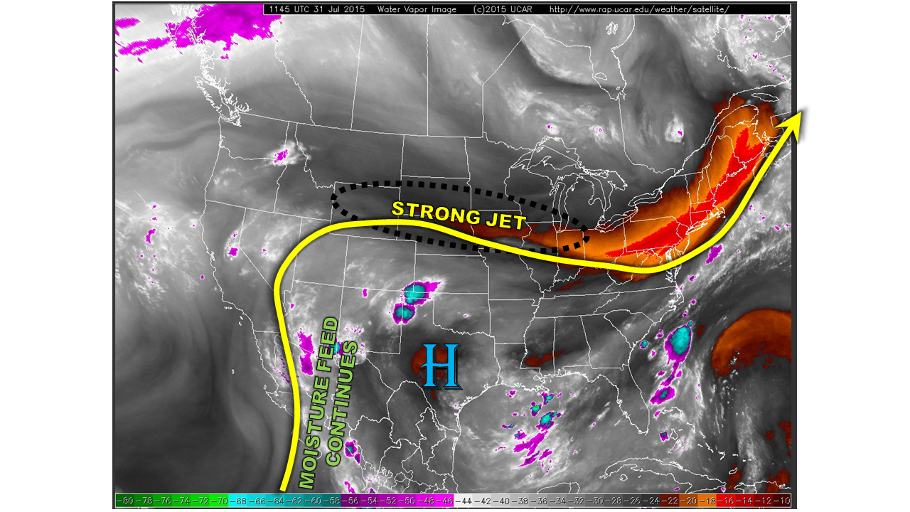
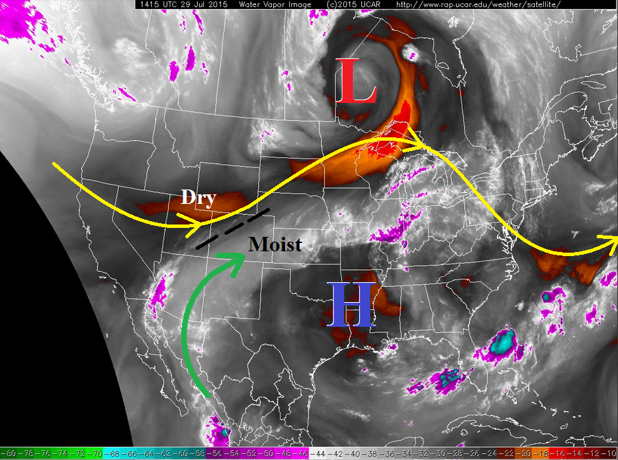
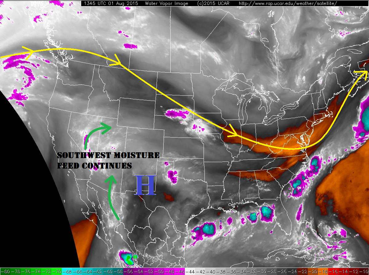
Current observations show the broad, high pressure ridge continues to sit across the western US, with the mid-level circulation center over southeast NM. This overall setup will remain throughout this forecast period, allowing for the stream of subtropical moisture to continue flowing into Colorado. Precipitable water values continue to be above average statewide, with the best moisture across southern and western portions of the state. Embedded in the flow aloft is a disturbance that will work across southern and southwestern Colorado today/tonight, acting as a trigger for scattered mountain thunderstorms. Further north across the mountains, orographic effects will be responsible for the development of isolated thunderstorms.
Weak steering winds aloft will make it difficult for storms to move over the lower elevations of eastern Colorado, but a few isolated storms are expected to do just that. Western portions of the Raton Ridge, Southeast Plains, and Palmer Ridge, as well as the Urban Corridor along and south of I-70, will see a couple isolated thunderstorms this afternoon/evening. Heavy rain will be a threat with current moisture values, but a lack of organizational support aloft will mitigate the threat. In spite of this, efficient rainfall processes will occur. Maximum rain rates are discussed below in the zone-specific forecasts. Elsewhere across eastern Colorado, mostly sunny skies and hot temperatures will be the main story.
The Northeast Plains will hold a slight chance of seeing a couple of isolated thunderstorms this afternoon/evening, as a weak surface trough will lay across the area. Plenty of surface heating and moisture will be available to produce thunderstorms, the question is whether or not they can overcome the mid-level warm layer that will try and hold them down. If storms can develop, they will bring a threat of heavy rain and small hail, as well as gusty winds and lightning.
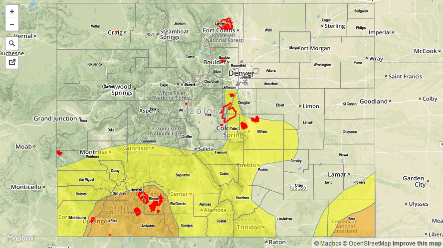
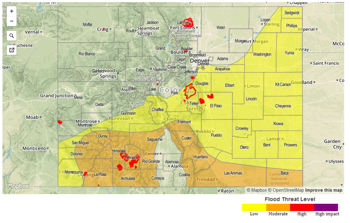
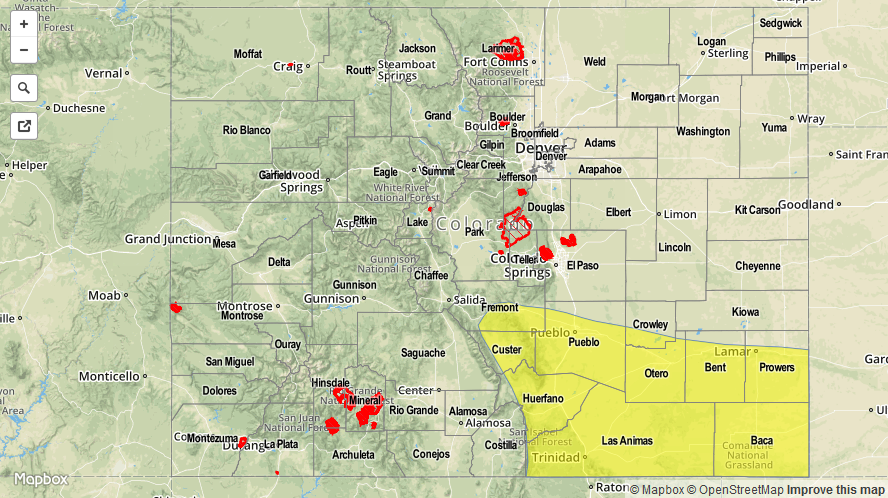
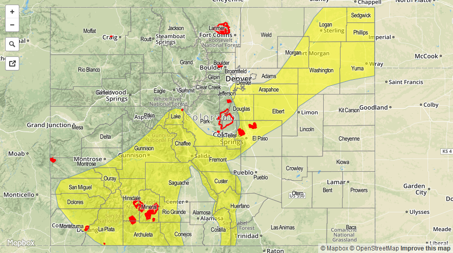
Today’s Flood Threat Map
For more information on today’s flood threat, see the map below (hover over threat areas for more details). For Zone-Specific forecasts, jump below the map.

Zone-Specific Forecasts
Urban Corridor, Northeast Plains, Raton Ridge, Palmer Ridge, and Southeast Plains:
Isolated thunderstorms are expected this afternoon for the Urban Corridor (mainly along and south of I-70), and western portions of the Raton Ridge, Southeast Plains, and Palmer Ridge. The Northeast Plains conditional chances are described above. Slow-moving storms near the higher terrain are a concern, mainly for urban areas. Maximum rain rates are as follows:
Urban Corridor:0.6-1.2 inches/hour
Raton Ridge and Southeast Plains: 0.8-1.4 inches/hour
Northeast Plains: 1.2-2.0 inches/hour
Timing: 1 PM – 9 PM, with a thunderstorm or two lingering until just after midnight over the Northeast Plains.
Northwest Slope, Northern Mountains, Front Range, Central Mountains, and Grand Valley:
Isolated thunderstorms are expected to develop early and continue into the evening hours before diminishing with the loss of daytime heating. Rain rates will mainly stay in the 0.2-0.4 inches/hour range, but a stronger storm over the Central Mountains and Front Range could result in maximum rain rates of 0.8-1.2 inches/hour. Slow-moving storms will be a concern over the Front Range and Central Mountains. Otherwise partly sunny skies will prevail with warm temperatures.
Timing: 11 AM – 8 PM, with a couple showers/weak thunderstorms lingering over the Central Mountains until about 11 PM.
Southeast Mountains, San Luis Valley, San Juan Mountains, and Southwest Slope:
Scattered showers and thunderstorms are expected today and tonight, with a few continuing into tomorrow morning across the San Juan Mountains and Southwest Slope. Efficient rainfall processes will occur with the amount of moisture available, so heavy rainfall from slow-moving storms will be a threat. Maximum rain rates will be 1.2-1.6 inches/hour, or 1.8-2.4 inches over 3 hours. Burn scars and saturated soils should be watched closely for issues, as they will be most susceptible to flash flooding/mud flow issues.
Timing: 11 AM – 10 PM, with a few showers and thunderstorms continuing into tomorrow morning.