Issue Date: Wednesday, June 1st, 2016
Issue Time: 10:35AM MDT
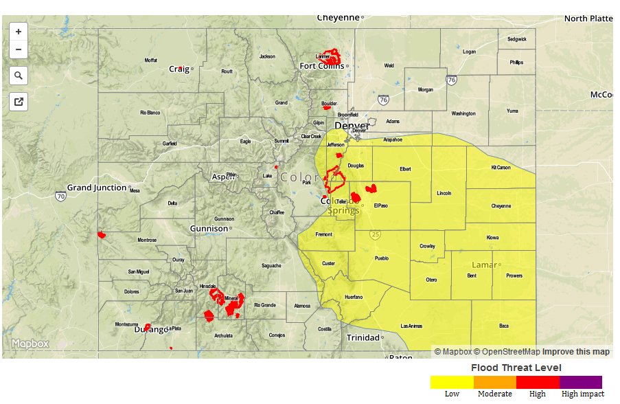
— A LOW flood threat has been issued for parts of the Northeast Plains, Front Range, Urban Corridor, Palmer Ridge, Southeast Mountains, Raton Ridge and Southeast Plains
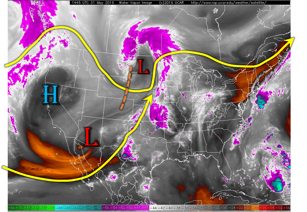
It is June 1st, official summer by the astronomical calendar, and it certainly shows on this morning’s weather map. Unlike the nice, organized disturbances of winter and spring, this morning’s water vapor image, below, shows many features all dueling to impact the day’s weather.
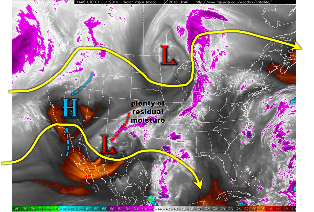
The most notable feature is the cut-off low centered over southeast Arizona that has been crawling eastward for about the last 5 days. It is far removed from our state to have a limited factor, but a factor nonetheless. Associated with it is a weak disturbance, noted most easily in the mid-level vorticity field. This feature will help spark off thunderstorms mostly east of the Divide today. An inspection of this morning’s atmospheric soundings shows a very deep layer of moisture extending from the surface to about 13,000 feet at Denver. Precipitable water values remain near or slightly above seasonal normal, ranging from 0.7 to 0.9 inches east of the Divide. Finally, just like last night, it appears that a nocturnal low-level jet will again provide instability for late evening thunderstorms over the Urban Corridor and Northeast Plains. In all, a wide-covering Low flood threat is in order today.
Today’s Flood Threat Map
For more information on today’s flood threat, see the map below (hover over threat areas for more details). For Zone-Specific forecasts, scroll below the map.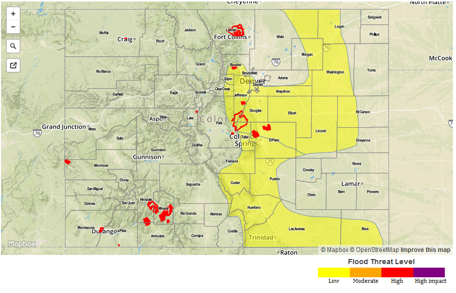
Zone-Specific Forecasts:
Front Range, Urban Corridor, Northeast Plains, Palmer Ridge:
Partly sunny early with scattered showers and thunderstorms developing by early afternoon and lasting into the early evening with a secondary wave of storms possible in the early overnight hours. Maximum 1 hour rainfall rates up to 1.7 inches are possible, leading to isolated field and roadway flooding. Mud slides and debris flows are possible in steeper terrain. A Low flood threat has been posted for parts of the region.
Primetime: 1pm to 1am
Southeast Plains, Southeast Mountains, Raton Ridge, San Juan Mountains, San Luis Valley:
Partly sunny early with scattered showers and thunderstorms developing by noon and lasting into the early evening. Maximum 1 hour rainfall rates up to 1.7 inches are possible, leading to isolated field and roadway flooding. Mud slides and debris flows are possible in steeper terrain. A Low flood threat has been posted for parts of the region.
Primetime: 1pm to 8pm
Central Mountains, Northern Mountains, Grand Valley, Northwest Slope, Southwest Slope:
Mostly sunny early then partly cloudy skies. An isolated showers and perhaps a weak thunderstorm is possible over the higher terrain, with dry conditions elsewhere. Max hourly rain rates up to 0.2 inches. Flooding is not expected today.