Issue Date: Thursday, September 1, 2016
Issue Time: 10:50AM MDT
— LOW flood threat for San Juans, Central Mountains, Southeast Mountains
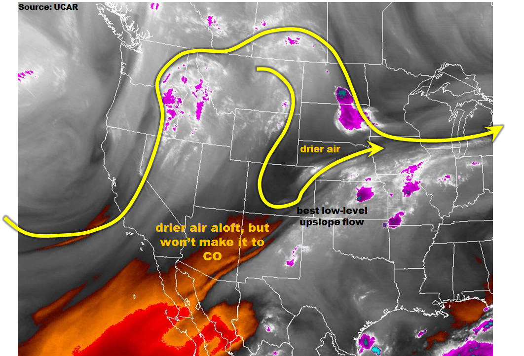
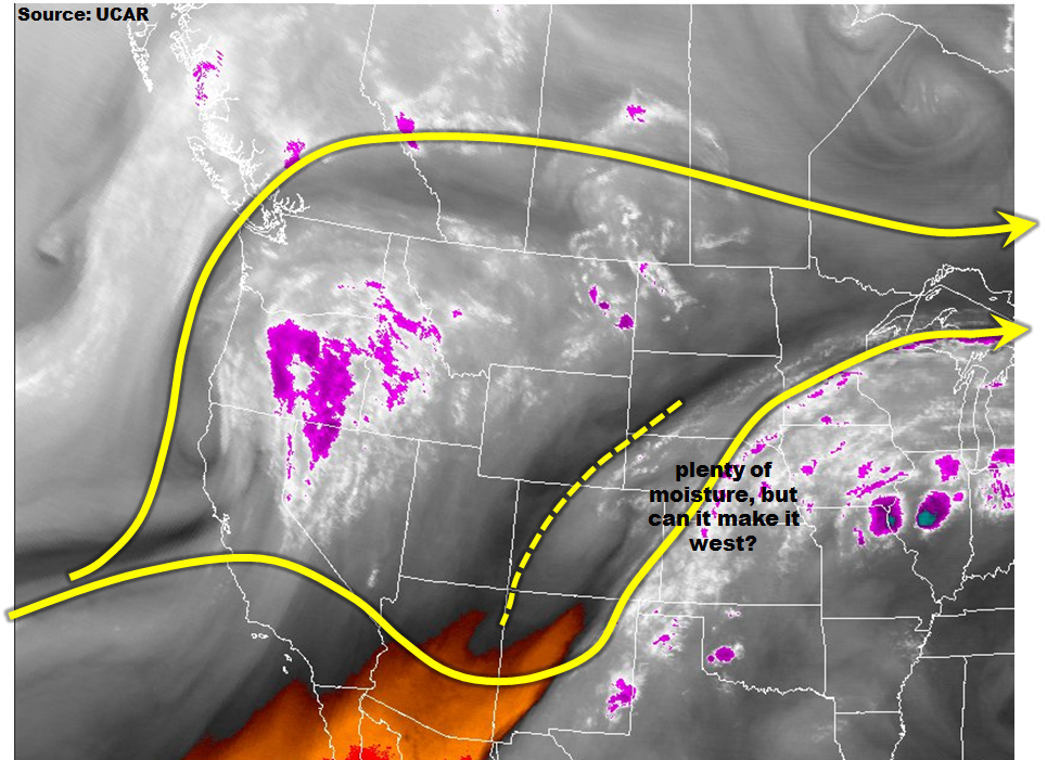
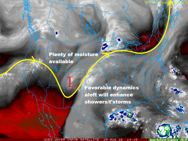
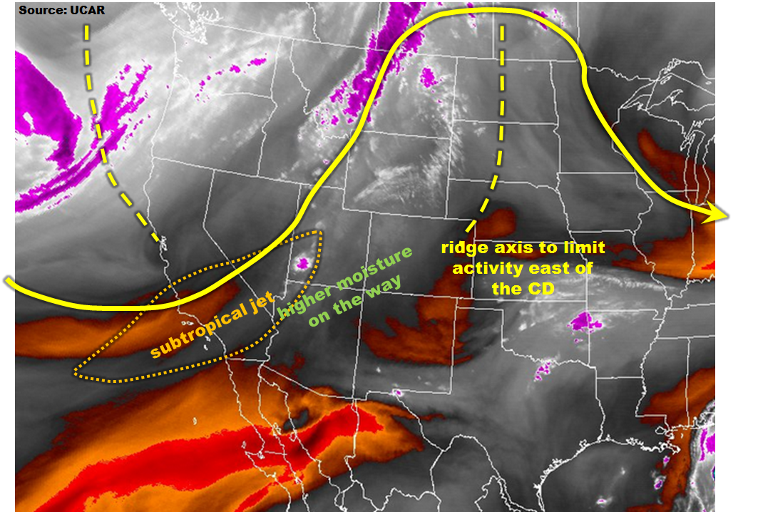
Major changes are on the way for Colorado’s weather, as can be seen by the water vapor image, below. A large-scale trough is entering the western coast of North America. This feature is also being supported by a strong subtropical jet streak centered over southern CA, NV and UT. This jet will slowly approach Colorado, and provide favorable outflow winds for any thunderstorm activity that develops. An associated surface low pressure system, centered over the northern Great Basin, will begin to transport higher moisture content west of the Divide. Thus, thunderstorm activity will increase today along the western slope, most notably over the climatologically favored San Juans. Farther east, a decaying disturbance has allowed a ridge axis to stretch into northeast CO from the northeast. This will provide light subsidence in the mid-levels and be generally unfavorable for storm activity. However, with the high residual moisture content in place (dewpoints > 55F, precipitable water 0.8 – 1.2 inches), a rogue storm cannot be ruled out. Today, we have a Low flood threat out for the southern parts of the state where dynamics and moisture will be juxtaposed best for thunderstorm formation.
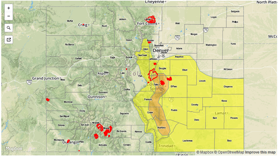
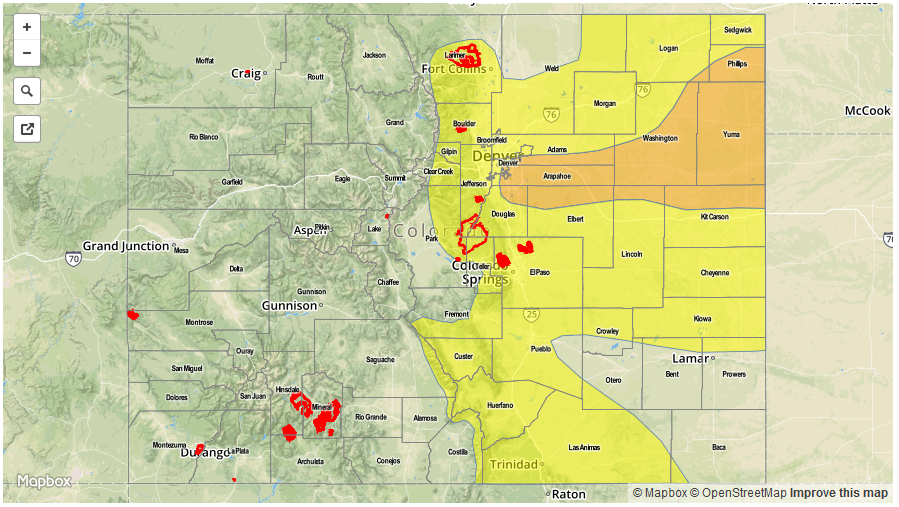
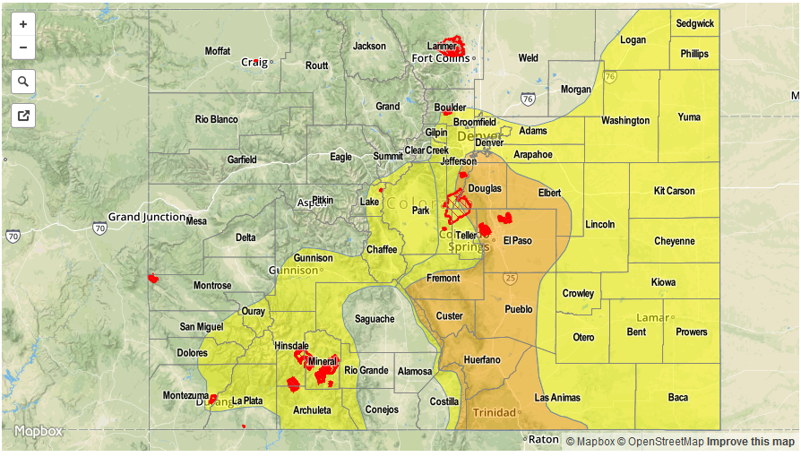
Today’s Flood Threat Map
For more information on today’s flood threat, see the map below (hover over threat areas for more details). For Zone-Specific forecasts, scroll below the map.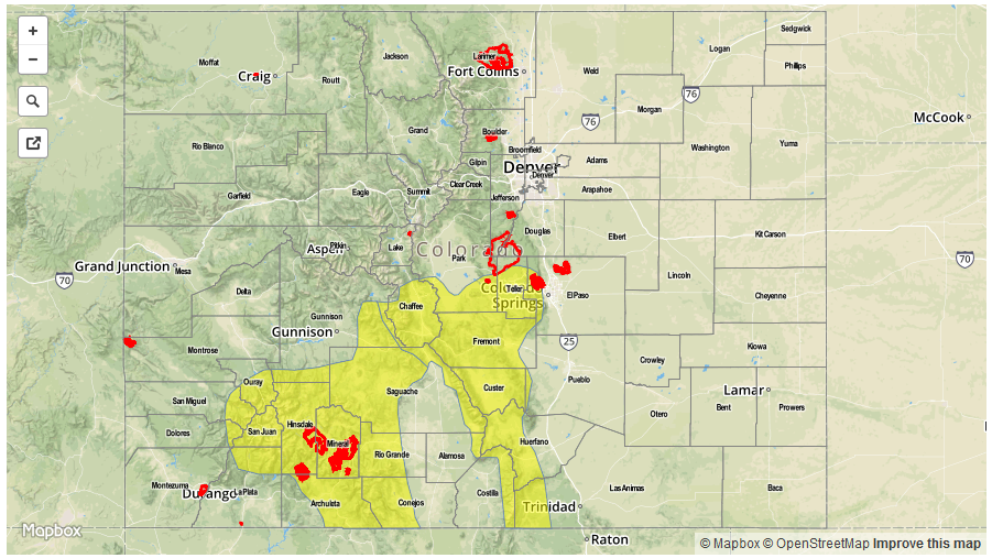

Zone-Specific Forecasts:
San Juan Mountains, Southwest Slope, Grand Valley:
Mostly sunny this morning then scattered thunderstorms and showers developing by early afternoon. Coverage will be initially be highest in the San Juans but will eventually increase farther north. Max 1-hr rain rates up to 1.0 inch possible with max 24-hour rainfall up to 1.6 inches. Moderate rainfall could continue overnight in the San Juans. A Low flood threat has been issued for southern parts of the region mainly for debris slides and mud flows as the region has experienced above normal rainfall the past 7-14 days. The snow level will be about 12,500 ft but could be lower under stronger cells.
Primetime: 2PM to 2AM
Southeast Mountains, Raton Ridge, Central Mountains:
Mostly sunny this morning then isolated to scattered thunderstorms developing by early afternoon. Max 1-hr rain rates up to 1.4 inches could lead to isolated flash flooding, debris slides and mud flows. The Hayden Pass fire scar is especially vulnerable given some antecedent rainfall yesterday. A Low flood threat has been posted for parts of the region.
Primetime: 12PM to 8:30PM
Front Range, Urban Corridor, Palmer Ridge, Northeast Plains, Southeast Plains:
Sunny early then isolated to scattered thunderstorms developing by early afternoon. Maximum 1-hr rain rates up to 1.3 inches in the far east and up to 0.7 inches closer to the foothills. Flooding is not expected today.
Primetime: 1PM to 9PM
San Luis Valley, Northwest Slope, Northern Mountains:
Mostly sunny early then isolated to scattered showers and a weak thunderstorm developing by early afternoon. Max 1-hr rain rates up to 0.4 inches possible. Light rainfall could continue into the overnight hours in the northern area. Flooding is not expected today.