Issue Date: Wednesday, May 31st, 2017
Issue Time: 10:40AM MDT
— LOW flood threat for parts of Northeast Plains, Palmer Ridge, Raton Ridge and Southeast Plains
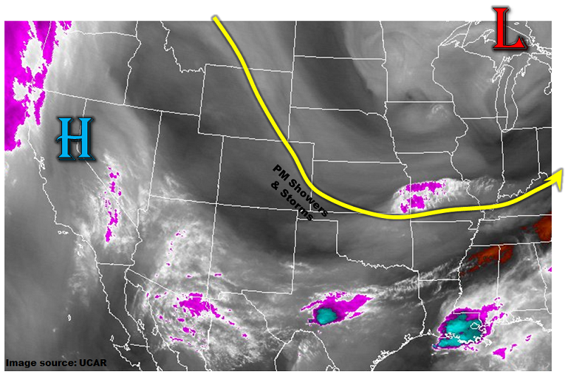
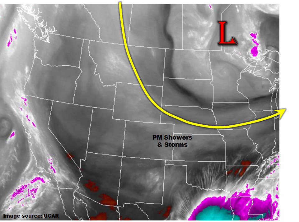
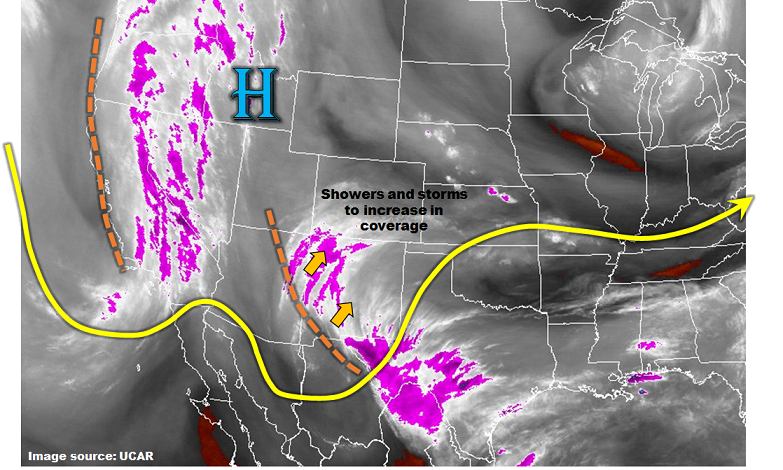
With plenty of morning sunshine, temperatures will continue their steady trend upwards today across Colorado. Moisture also continues to increase, albeit slowly, as weak southeasterly flow brings in moist air from the Southern Plains. Added to the mix is an approaching disturbance from the southwest (see water vapor image below) that will cause upward motion downstream of its vorticity axis. Collectively, expect shower and storm coverage to increase today across southwest and eastern Colorado. Most rainfall will be of the light to moderate variety, and not pose a flood threat. However, two areas are exceptions to this rule. First, along the Raton Ridge, early instability will provide scattered storms that will be capable of heavy rainfall due to slow storm motion (much like Monday). Second, in the Northeast Plains and far eastern Colorado, higher instability and favorable directional and speed shear profiles suggest isolated severe storms. With precipitable water approaching 0.7-0.8 inches this afternoon, isolated heavy rainfall will be possible with these. In addition, large hail is also possible.
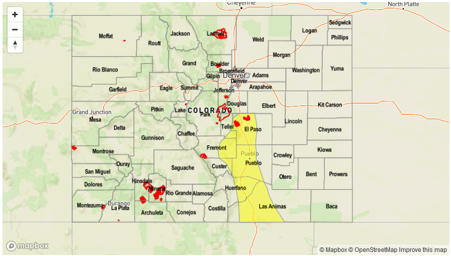
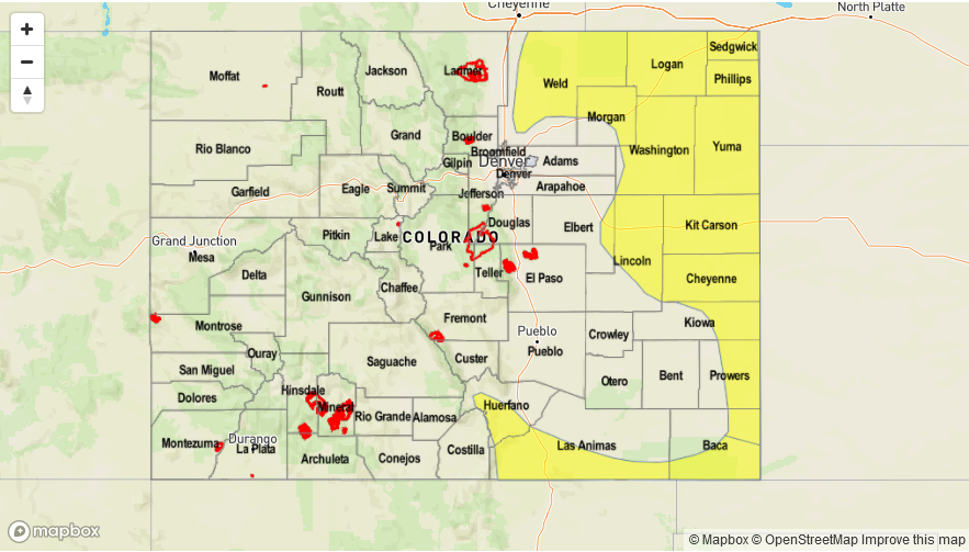
Today’s Flood Threat Map
For more information on today’s flood threat, see the map below (hover over threat areas for more details). For Zone-Specific forecasts, scroll below the map.

Zone-Specific Forecasts:
Southeast Plains, Northeast Plains, Front Range, Urban Corridor, Palmer Ridge:
Mostly clear this morning then partly to mostly cloudy with scattered showers and thunderstorms developing by early afternoon. Highest coverage will be in the foothills as well as in the Northeast Plains, with a lull over the Urban Corridor. Max 1-hour rainfall up to 1.8 inches. A Low flood threat has been posted for parts of the region for isolated flash flooding. Large hail, up to 2.25 inches could accompany the strongest storms Northeast Plains.
Primetime: 2PM to 9PM
Raton Ridge, Southeast Mountains, San Juan Mountains, San Luis Valley, Southwest Slope:
Partly cloudy this morning the scattered showers and thunderstorms possible this afternoon. Max 1-hour rain rates up to 0.5 inches west of the Continental Divide (max 24-hour rainfall up to 0.8 inches), and 1.1 inches to the east. A Low flood threat has been posted for parts of the region for isolated flash flooding, debris slides and mud flows.
Grand Valley, Northwest Slope, Northern Mountains, Central Mountains:
Sunny this morning then becoming partly cloudy with isolated showers and a weak thunderstorm possible mainly in the higher elevations of the San Juans and southern portions of the Central Mountains. Max 1-hour rainfall up to 0.3 inches. Small hail (up to 0.25 inches) could accompany the stronger cells. Flooding is not expected today.
Primetime: 12PM to 7PM