Issue Date: Sunday, July 30th, 2017
Issue Time: 10:30AM MDT
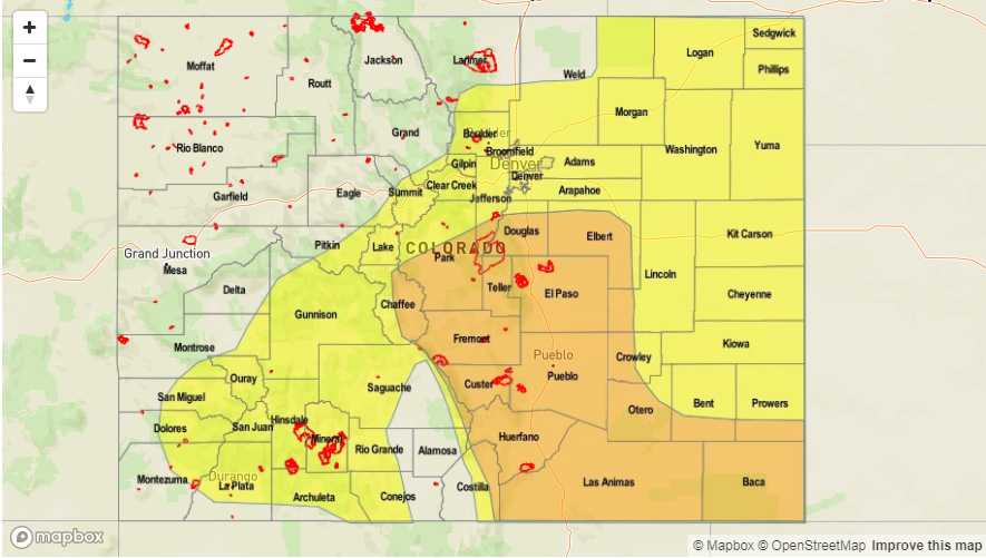
— MODERATE/LOW flood threat for portions of the Front Range, Urban Corridor, Palmer Ridge, Central Mountains, Southeast Mountains, Raton Ridge, Southeast Plains
— LOW flood threat for Southwest Slope, San Juan Mountains, Northeast Plains
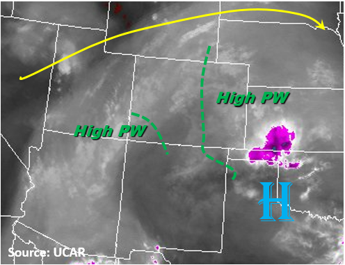
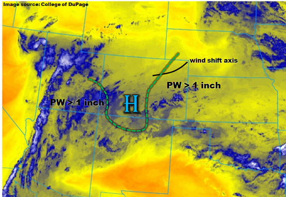
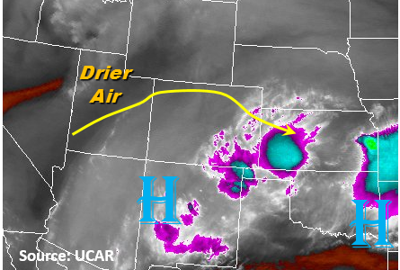
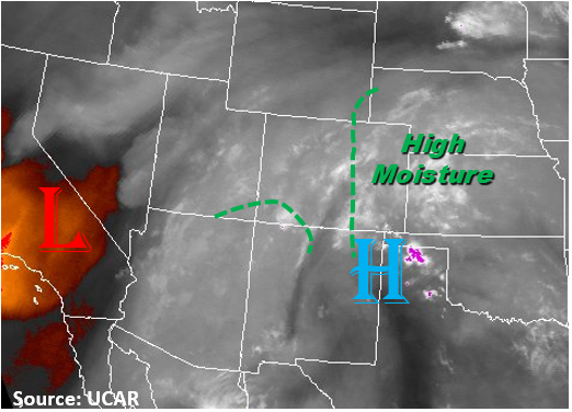
The monsoon moisture plume sticks around for another round of thunderstorms today. The Denver sounding this morning had 1.13 inches of Precipitable Water (PW), while the Grand Junction sounding had 0.93 inches with more drying in the mid-levels. Dew points over the eastern plains are as high as 65F and are also still high over the southwestern corner of the state. The high PW is marked in the water vapor image below. The mid-levels may dry out a bit over the course of the day with winds from the north, but not enough to limit heavy rainfall again this afternoon. Cloud cover continues over the southern and central mountains as well as the southern Urban Corridor, Palmer Ridge and Southeast Plains. The cloud cover will help limit temperatures again today, but has a much better chance of at least partially burning off by the afternoon allowing some instability to build unlike yesterday. With the ridge off to our north over Canada, light westerly flow will be present at the upper-levels.
Expect storms to start firing off the higher terrain just after noon to the north and a bit sooner over the south. Storms will begin to slowly move off the mountains onto the adjacent plains in the late afternoon likely favoring the higher terrain of the Palmer Divide and Raton Ridge. Storm motion will be 10-15 knots moving E/SE. Rain rates over the mountains will be as high as 1.3 inches in 1-hour with 3 to 6-hour totals up to 2 inches. There is a chance storms forming over the Cheyenne Ridge may move over the border into the Northeast Plains.
Over the San Juan Mountains, storm totals around 2 inches will warrant a Low flood threat with the antecedent rainfall. Heavy rainfall again today will create dangerous conditions over already saturated soils and burn scars. Threats include mud flows, debris slides, small stream and road flooding, so burn scars need to be watched carefully again today. Over the adjacent plains, expect storms to have max 1-hour rain rates up to 2.25 inches with 3-6 hour totals up to 4 inches. Threats include arroyo and street flooding as well as field ponding. Storms over the mountains should end a couple hours after sundown, while storms over the SE corner of the state will continue until midnight.
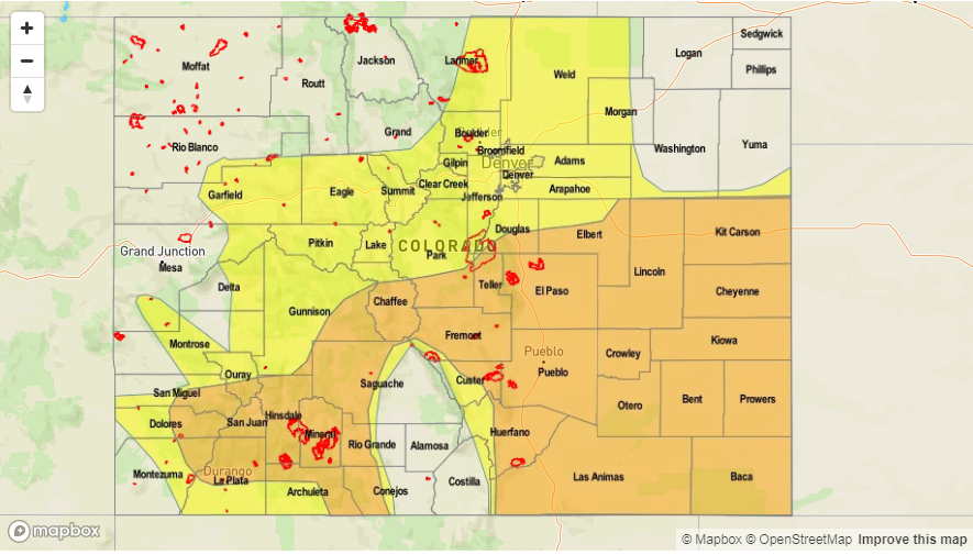
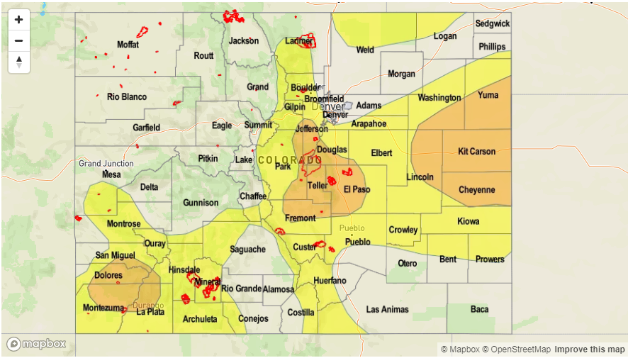
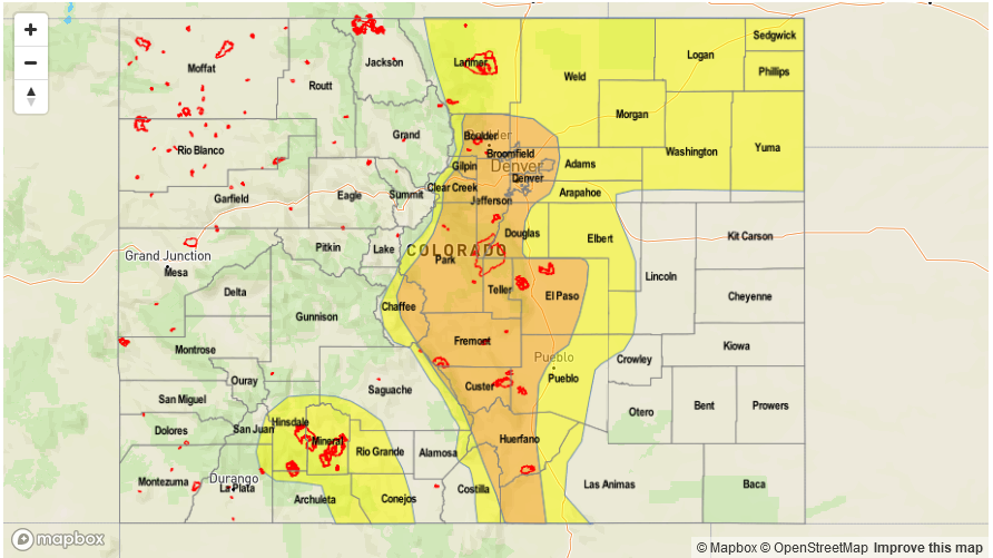
Today’s Flood Threat Map
For more information on today’s flood threat, see the map below (hover over threat areas for more details). For Zone-Specific forecasts, scroll below the map.

Zone-Specific Forecasts:
Front Range, Urban Corridor, Palmer Ridge, Northeast Plains, Central Mountains, Southeast Mountains, Raton Ridge, Southeast Plains:
Partly cloudy early with sunshine breaking through the clouds midday. Scattered to numerous showers and thunderstorms developing by early afternoon over the higher terrain. Max 1-hr rainfall up to 2.25 inches (adjacent plains) and 1.3 inches (mountains). Local 3-hour rainfall totals up to 4 inches over the plains. Threats include mud flows, debris slides, field ponding and arroyo and road flooding. The threat should diminish by midnight.
Primetime: 12PM to 12AM
Northwest Slope, Grand Valley, Southwest Slope, Northern Mountains, San Juan Mountains, San Luis Valley:
Partly cloudy this morning over the southern high terrain becoming more sunny over the Central Mountains. Heavier rainfall is expected over the San Juan Mountains with max 1-hr rainfall up to 1.1 inch. 3-6 hour rainfall amounts up to 2.2 inches are possible. A Low flood threat has been posted with threats including isolated mud flows and debris slides over saturated soils.
Primetime: 11:30AM to 10PM