Issue Date: Monday, September 4, 2017
Issue Time: 09:40AM MDT
— Flooding is NOT expected today
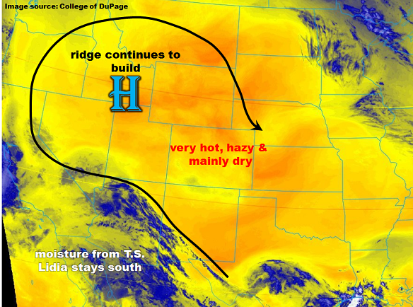
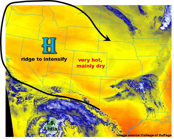
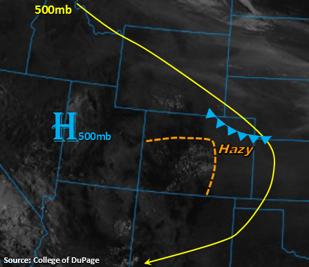
A few high clouds are present this morning over the Front Range and Central Mountains. Smoke from the wildfires in Idaho and Montana continue to limit visibility over the northern portion of the state and eastern plains as seen in the visible satellite image below. Visibility will be reduced to 2 to 4 mile range in the heaviest smoke over the eastern plains. The high pressure continues to sit west of the state, but a cold front is expected to drop south over the eastern plains late this afternoon and push through the rest of the plains overnight. As the front moves south, this may give some relief to northeast portion of the state from the hazy skies and warm temperatures. West of the Continental Divide, the ridging pattern will continue to encourage high temperatures and entrain smoke into the northern portion of the state.
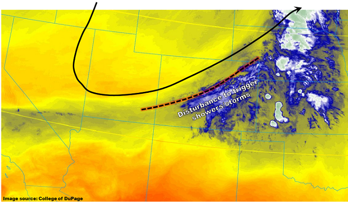
There is a chance for a few stronger storms to form along the cold front later this afternoon and evening as well as with upslope flow in climatologically favored regions. The best chance for showers and thunderstorms is along the Palmer Ridge, Southeast Mountains and San Juan Mountains. Storm coverage will increase over the high terrains when compared to the last couple of days. With Precipitable Water (PW) values in the 0.6 – 0.7 inch range, storms are expected to be short-lived and have limited rainfall totals. Gusty winds may accompany the stronger storms that form, especially along the cold front. The passage of the cold front later this evening and overnight will reduce low temperatures and bring relief from the high temperatures tomorrow.
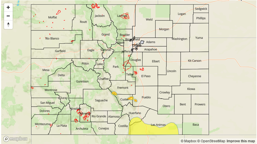
Today’s Flood Threat Map
For more information on today’s flood threat, see the map below (hover over threat areas for more details). For Zone-Specific forecasts, scroll below the map.

Zone-Specific Forecasts:
Southeast Mountains, Raton Ridge, Southeast Plains, San Juan Mountains, Palmer Ridge:
Sunny this morning becoming partly cloudy this afternoon with increased coverage of storms over the higher terrains. Showers and thunderstorms are expected to initiate later this afternoon and evening and stronger storms will likely produce gusty winds. Max 1-hr rain rates up to 0.6 inches (east) and 0.4 inches (west). Flooding is not expected today.
Primetime: 12PM to 8PM
Front Range, Urban Corridor, Northeast Plains:
Sunny this morning with smoke. Reduction in smoke expected this afternoon with the passage of a cold front. Shower coverage is expected to increase over the Front Range, but limited rainfall will reach the surface. Storm totals are expected to be under 0.1 inches. Flooding is not expected today.
Primetime: 1PM to 8PM
Northwest Slope, Grand Valley, Southwest Slope, Northern Mountains, San Luis Valley, Central Mountains:
Sunny this morning becoming partly cloudy this afternoon over the higher terrains. Temperatures are expected to reach the mid-90s in the lower elevations. Isolated showers may occur over the southern high terrains, but storm totals are expected to be under 0.1 inches. The north portions of these regions will have some reduction in visibility due to the fires in Idaho and Montana.
Primetime: 1PM to 8PM