Issue Date: Tuesday, September 12, 2017
Issue Time: 11AM MDT
— LOW flood threat for Hayden Pass burn scar
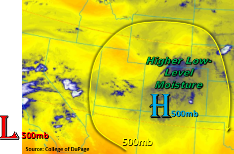
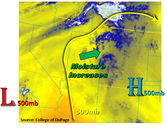
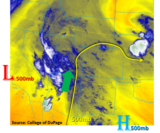
This morning’s water vapor image, below, shows a relatively persistent upper-level pattern across the central and western United States. Colorado remains under the influence of a weak ridge with troughs of low pressure to the east and west. However, change is on the way. The ridge will weaken today as the western trough begins to move eastward. But overall, atmospheric dynamics are not a strong factor today.
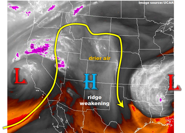
Without dynamics, we turn to moisture and instability analyses to provide clues about heavy rainfall potential. Mainly clear skies this morning will allow for weak to moderate instability to quickly develop over the High Country. Morning Precipitable Water (PW) readings were 0.76 and 0.84 inches in Denver and Grand Junction, respectively. Little if any moisture advection is expected today so PW is expected to maintain its values. Low-level moisture remains above average for this time of year with surface dew point temperatures in the mid-40s to mid-50s. Some of this moisture will mix out in the afternoon, limiting storm inflow and capping rainfall intensity. Another notable factor is dry mid-level air coming into the state from Wyoming. This will lower the rainfall coverage compare to yesterday.
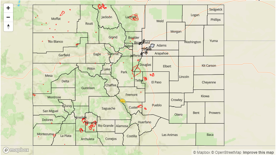
Putting it all together, we expect isolated to scattered afternoon and evening showers/storms mainly in the southern High Country. Max rainfall is expected to stay just below flash flood thresholds. The only exception is for burn scars. In particular, precipitation chances for the Hayden Pass scar are high today with a ~30% chance of exceeding 0.5 inches per hour. Thus, a Low flood threat has been posted for this scar. Elsewhere, flooding is not expected today.
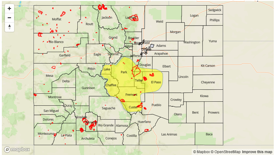
Today’s Flood Threat Map
For more information on today’s flood threat, see the map below (hover over threat areas for more details). For Zone-Specific forecasts, scroll below the map.

Zone-Specific Forecasts:
Southeast Mountains, Raton Ridge, Southeast Plains, San Juan Mountains, Front Range, Urban Corridor, Palmer Ridge, Northeast Plains:
Sunny early, then turning partly cloudy with isolated to scattered showers and thunderstorms this afternoon and evening. Highest coverage will be over the southern High Country and adjacent foothills. Max 1-hour rainfall up to 1.1 inches (below 6,000 feet) and 0.9 inches (above 6,000 feet). A Low flood threat has been posted for the Hayden Pass fire scar for isolated flash flooding, mud flows and debris slides. Elsewhere, flooding is not expected today.
Primetime: 1PM to 9:30PM
Northwest Slope, Grand Valley, Southwest Slope, Northern Mountains, Central Mountains, San Luis Valley:
Partly cloudy early then scattered showers and thunderstorms this afternoon. Highest coverage will be over the Central Mountains and especially the San Juans. Max 1-hour rain rates up to 0.7 inches with max 24-hour totals up to 1.1 inches. Flooding is not expected today.
Primetime: 1PM to 8PM