Issue Date: Saturday, September 16th, 2017
Issue Time: 8:45 AM MDT
— Flooding is NOT expected today
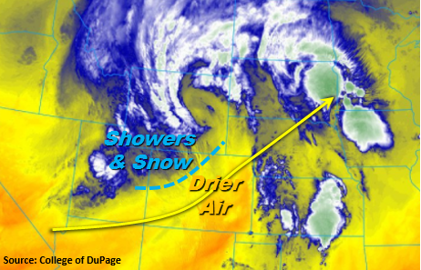
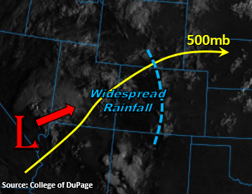
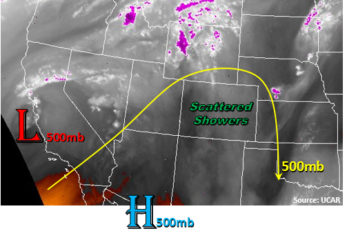
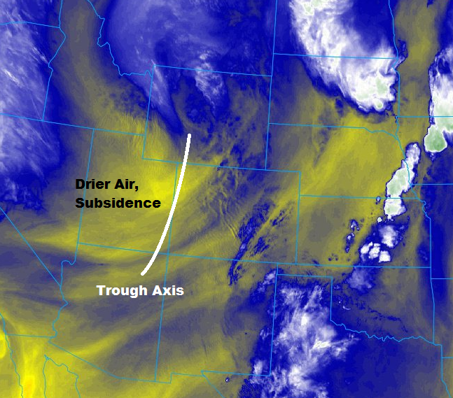
TThe upper-level low that has been responsible for the unsettled weather the past few days will finally get out of the area today, as the trough axis swings across the state. The current position of the axis is denoted on the water vapor image below, with drier, subsident air following behind. Ahead of the axis, more showers, and perhaps a thunderstorm or two, will kick off today, producing mainly light precipitation and gusty winds. The depth of the moisture isn’t sufficient enough to produce much more than that. A few isolated showers/weak thunderstorms will continue into the nighttime hours along/east of the Front Range as weak upslope flow and lingering moisture remain across the region.
One region to keep an eye on for an isolated, strong thunderstorm or two will be the far Southeast Plains, mainly Baca, Bent, Prowers, and far eastern Las Animas counties. Low-level convergence along the lingering cold front will provide the necessary lift and moisture, as long as the upper-level subsident air doesn’t work into the area to suppress development. Brief heavy rainfall and strong winds will result from any activity in this area. The time frame for any storms to develop in this area will be from 5 PM – Midnight. For more details, please see the zone-specific forecast discussions below.
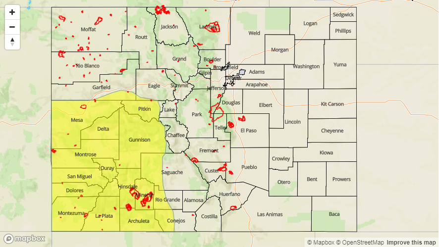
Today’s Flood Threat Map
For more information on today’s flood threat, see the map below (hover over threat areas for more details). For Zone-Specific forecasts, scroll below the map.

Zone-Specific Forecasts:
Urban Corridor, Palmer Ridge, Raton Ridge, Northeast Plains, and Southeast Plains:
Isolated-to-scattered showers will continue this morning across the Urban Corridor and Northeast Plains, mainly north of I-76. During the afternoon and evening hours, a few more showers/weak thunderstorms will develop across mainly the Urban Corridor, Palmer Ridge, and Northeast Plains, with another small area of focus mentioned above for the far Southeast Plains. Maximum rain rates from showers will be in the 0.05-0.15 inches/hour, with maximum rain rates from thunderstorms in the following ranges:
Urban Corridor: 0.2-0.5 inches/hour
Northeast Plains, Southeast Plains: 0.7-1.2 inches/hour
Palmer Ridge: 0.4-0.8 inches/hour
Raton Ridge: 0.2-0.4 inches/hour
Timing: Ongoing – Midnight
Northern Mountains, Northwest Slope, Front Range, Southeast Mountains, Central Mountains, San Luis Valley, San Juan Mountains, Grand Valley, and Southwest Slope:
A couple isolated showers over the high country will persist this morning, producing light rain and snow for the higher peaks. Activity will come to an end as the trough axis passes by through the afternoon hours. Maximum rain rates will be below flash flood thresholds:
Northern Mountains, Central Mountains, Northwest Slope, Grand Valley, Southwest Slope, San Juan Mountains, and San Luis Valley: 0.1-0.2 inches/hour
Front Range and Southeast Mountains: 0.25-0.5 inches/hour
Timing: Ongoing – 5 PM for locations west of the Continental Divide, Ongoing – 10 PM for areas along/east of the Continental Divide.