Issue Date: Saturday, September 24, 2017
Issue Time: 10:20 AM MDT
— LOW flood threat for the Southeast Plains, Raton Ridge, Northeast Plains
— Timing of flood threat is later than normal, and persists into the overnight hours
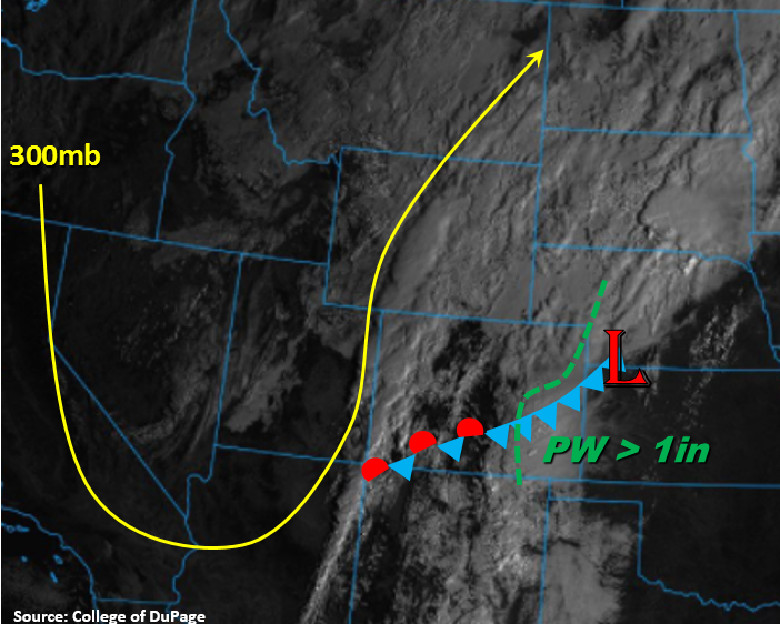
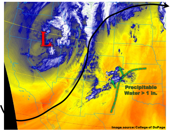
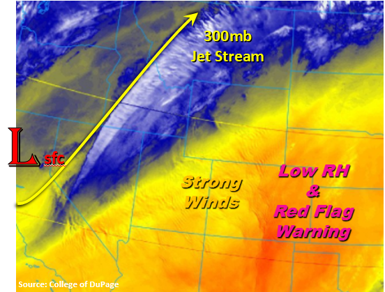
Heavy and widespread rainfall yesterday across the state. Much cooler temperatures in the wake of the cold front with 40s over the lower elevations and below freezing temperatures in the mountains. Heavy cloud cover over the eastern portion of the state with some convective showers still occurring over the Southeast Plains. A lot of fog was reported due to the increase in low level moisture and cooler temperatures. Currently, the western portion of the state is placed in the dry slot, so only a few clouds over the Northern Mountains. The upper trough will continue to move slowly eastward today and tonight. Colorado will continue to be under southwest flow aloft, which will draw in some drier air over western Colorado and inhibit rainfall. East of the Continental Divide, higher moisture will continue to reside, especially over the southeast corner of the state. Dew points over the plains are expected to reach 60F, so more heavy rain can be expected today and tonight.
Weaker showers are expected today over the higher terrains with snow at the higher elevations (9,500 feet). Upslope flow will continue behind the cold front with multiple upper level shortwaves enhancing lift. Expected scattered showers today and tonight. The highest accumulations are expected be in the Northern Mountains and northern Front Range. Over the southeast corner of the state, models hint at instability this afternoon with some decent shear. This could trigger a round of more convective storms capable of strong winds and small hail. Lift is expected to continue overnight, so expecting another round of showers in the moisture rich environment. High moisture paired with instability will aid in another 24-hour period of heavy rainfall accumulations. On top of accumulations yesterday, and increased runoff due to saturated soils, a Low flood threat has been issued. Threats include small stream and arroyo flooding, road flooding and field ponding.
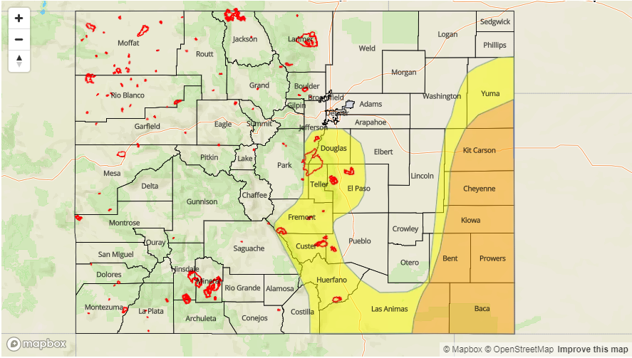
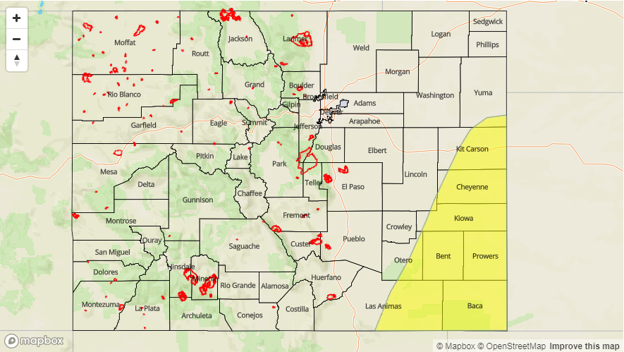
Today’s Flood Threat Map
For more information on today’s flood threat, see the map below (hover over threat areas for more details). For Zone-Specific forecasts, scroll below the map.

Zone-Specific Forecasts:
Palmer Ridge, Southeast Mountains, Raton Ridge, Front Range, Urban Corridor, Northeast Plains, Southeast Plains:
Cloudy this morning with increasing showers and thunderstorms over the northern, high terrains this afternoon. Some showers will move off the higher terrains into the Urban Corridor. Max 1-hr rain rates up to 0.5 inches possible. More convective rain is expected this afternoon over the Southeast Plains. Max 1-hour rain rates up to 1.5 inches are possible with isolated 24-hour rain totals up to 2.5 inches. Due to increased runoff from already saturated soils and high accumulations from yesterday, a Low flood threat has been issued. Threats include small stream and arroyo flooding, road flooding and field ponding. This is another overnight threat.
Primetime: 11AM to 7AM
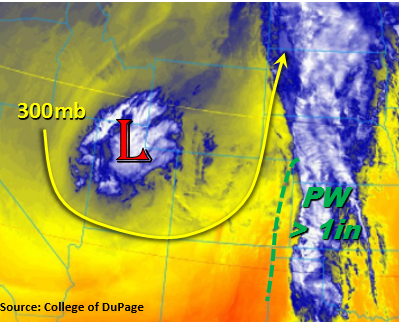
Northwest Slope, Grand Valley, Southwest Slope, Northern Mountains, Central Mountains, San Luis Valley, San Juan Mountains:
Partly cloudy over the northern high country with sunshine increasing as drier air works its way in from the southwest. Some light precipitation and cloud cover is likely over the Northwest Slope as increased moisture rotates around the upper level Low. Max 1-hour rain rates up to 0.3 inches are possible over the northwest corner of the state.
Primetime: 11AM to 8PM