Issue Date: Friday, May 18, 2018
Issue Time: 10:15AM MDT
— MODERATE/LOW flood threat for Front Range, Urban Corridor and Northeast Plains
— LOW flood threat for Southeast Plains and Palmer Ridge
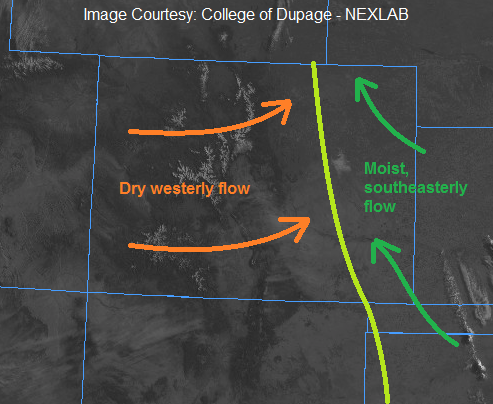
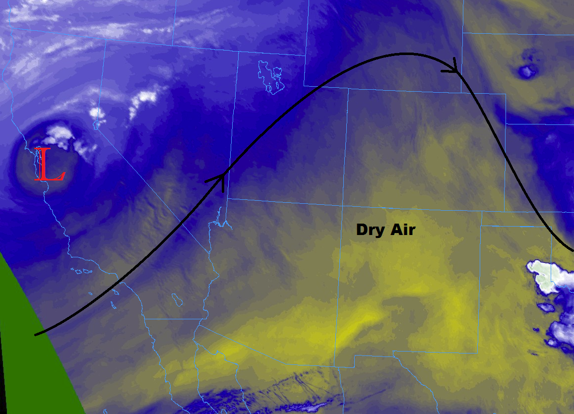
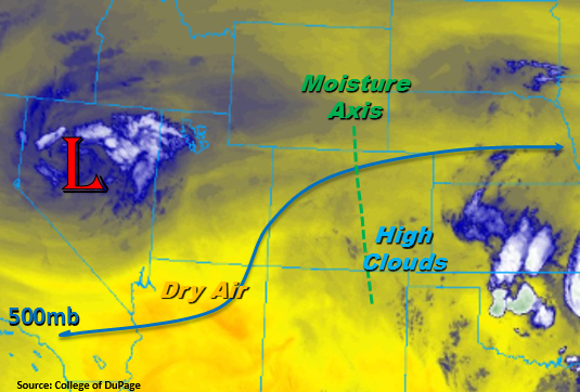
Quite a change to the weather pattern to start this weekend. As previously discussed in the FTO, the continuous low pressure that has been spinning over Nevada will finally begin to breakdown and eject over Wyoming this afternoon. Currently, the low is located in NW Utah and marked on the water vapor imagery below. This afternoon a lee cyclone is expected to form over the Southeast Plains, which will help pull higher moisture into the state to its north. It will also help trigger thunderstorm development over the Southeast Mountains and Raton Ridge. Strong convergence occurs on the east side of the lee cyclone, so storms that track into this area will be the focus for severe weather. Threats include large hail, gusty winds and a possible tornado. West of the Continental Divide, the main focus will be increased shower potential and cloud cover over the higher elevations.
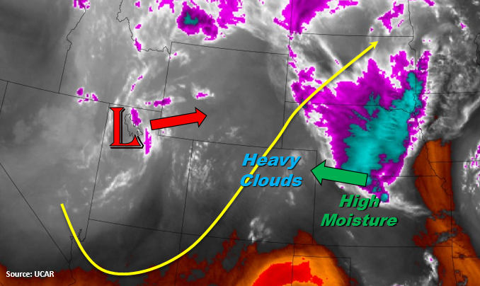
Over NE Colorado this morning, heavy cloud cover is present. Expecting cloud cover to modestly break up throughout the day, but increased lift associated with the trough and high moisture will likely keep the cloud deck somewhat intact over the Front Range. As the trough moves through this afternoon, it will help trigger widespread thunderstorms along the Front Range, Northern Mountains and Palmer Ridge. While these thunderstorms are expected to cluster into a MCS over the plains, a select few could become severe over areas with higher instability. The main threat with the stronger storms will be large hail, gusty winds and heavy rainfall. Rainfall is expected to continue overnight in the northern Urban Corridor and Northeast Plains. Over the higher elevations in the north, heavy snowfall is possible. For more details, please see the regional forecasts below.
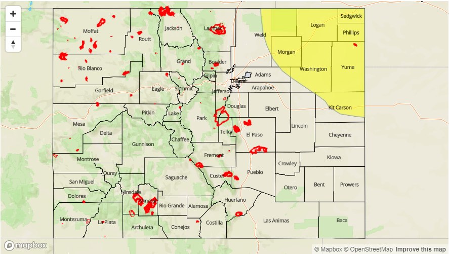
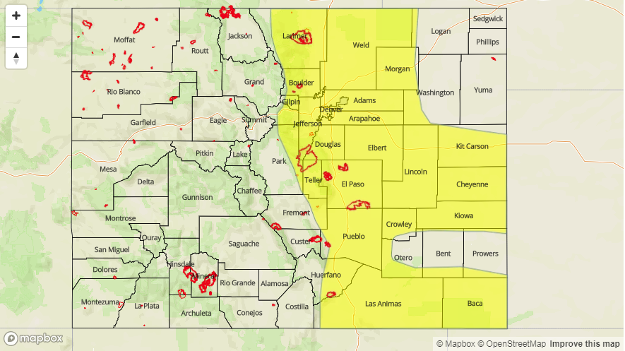
Today’s Flood Threat Map
For more information on today’s flood threat, see the map below. For Zone-Specific forecasts, scroll below the map.

Zone-Specific Forecasts:
Palmer Ridge, Front Range, Urban Corridor, Northeast Plains, Southeast Plains, Raton Ridge, Southeast Mountains:
Scattered showers and thunderstorms are expected today and tonight. A few storms may become severe further east. Over the Northeast Plains, localized totals up to 3.25 inches are possible by tomorrow morning. Flood threats over the Northeast Plains and Urban Corridor include small stream flooding, street flooding and field ponding. Over the northern high terrain small stream flooding and debris slides are possible. Burn scars in the area should be monitored closely this afternoon. A Moderate flood threat has been issued.
Maximum rain rates:
Northeast Plains: 1.75 inches/hour
Urban Corridor, Palmer Ridge, Raton Ridge and Southeast Plains: 1.25 inches/hour
Front Range and Southeast Mountains: 0.85 inches/hour
Primetime: 12PM to 11 AM
Northwest Slope, Grand Valley, Southwest Slope, Northern Mountains, San Luis Valley, San Juan Mountains, Central Mountains:
More cloud cover and scattered showers over the higher terrains are expected today. Moisture for showers, possibly accompanied by a role of thunder, is best over the Northern and Central Mountains. However, gusty winds are more likely than measurable rainfall. Max 1-hour rain rates up to 0.1 inches. Flooding is not expected today.
Primetime: 1PM to 9PM