Issue Date: Friday, June 15, 2018
Issue Time: 09:30AM MDT
— Flooding is NOT expected today
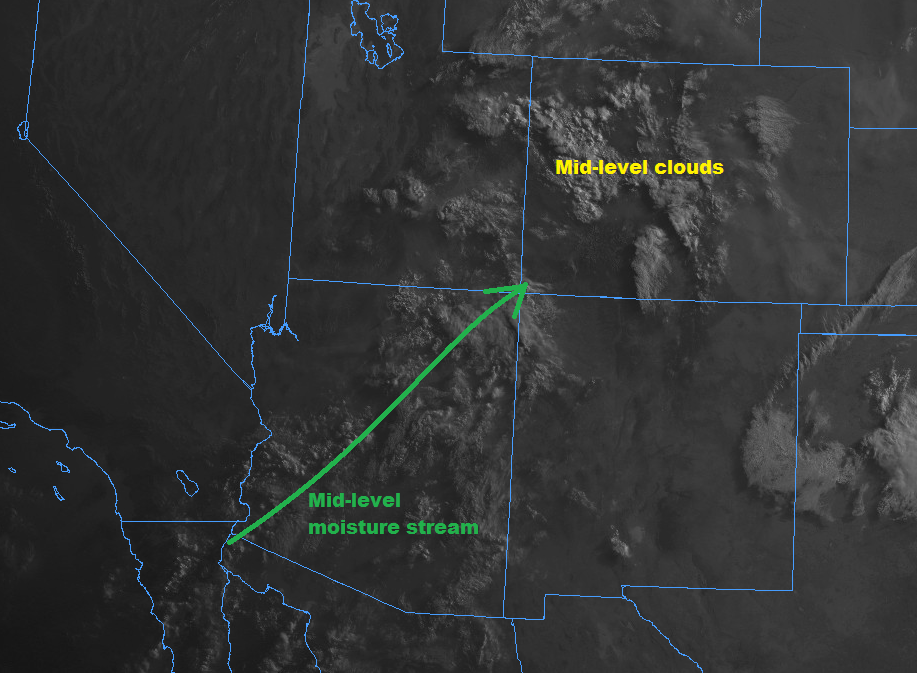
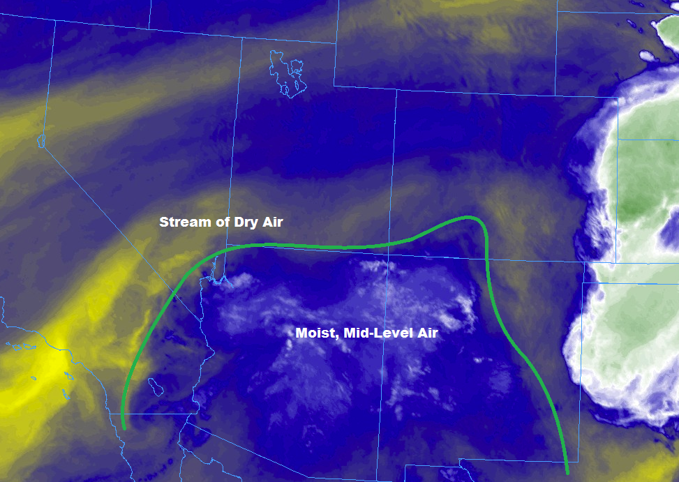
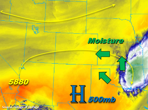
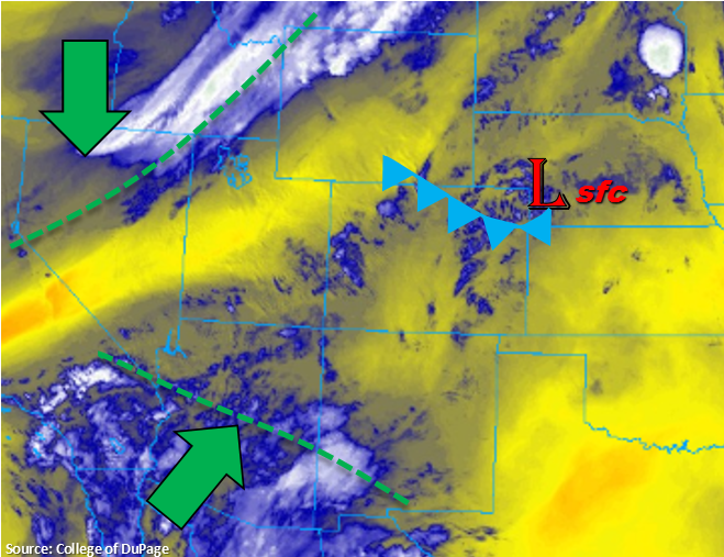
Everything is coming together for the cool and wet weekend. In the water vapor imagery below you can see the trough that will start to drop into Nevada/Northern California later today. You can also see the subtropical moisture from Bud starting to creep north over the southwest. But for today, that low level moisture won’t quite make it into western Colorado for the next round of afternoon thunderstorms and showers.
Soundings at both Grand Junction and Denver show quite a bit spread between the temperature and dew point at the surface, which should lead to another day of gusty winds and limited rainfall from the thunderstorms this afternoon. A Red Flag warning is in place over Western Colorado through this evening due to dry thunderstorms (strong outflows and lightning) creating critical fire conditions. Rainfall coverage and totals over the southwest corner of the state are expected to increase overnight as remnants of Bud moisten the lower levels. Please check back to the FTB tomorrow for more specific details as a Flash Flood Watch and High Flood Threat Outlook have been issued for the San Juan Mountains and 416/Burro burn scars on Saturday.
Over the Northeast Plains, behind the cold front, dew points are increasing into the mid 50Fs. A bit of this moisture will mix out this afternoon, but there is still enough in place for moderate rainfall this afternoon. The front is expected to stall out over the Palmer Ridge later this morning, so these higher dew points won’t quite reach the Southeast Plains. This will make showers and thunderstorms more isolated over the Southeast Mountains. Behind the front, upslope flow will increase as will thunderstorm coverage over the Front Range. More storms are forecast to form over the Palmer and Raton Ridges later this afternoon. Storm motion will be to the northeast at 15-20 knots, so flooding is not a concern. Threats today include gusty winds, dry thunderstorms and small hail. Storm activity over the eastern plains should end by 11PM. There is no flood threat today.
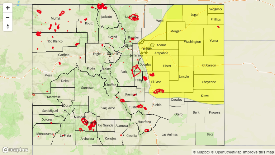
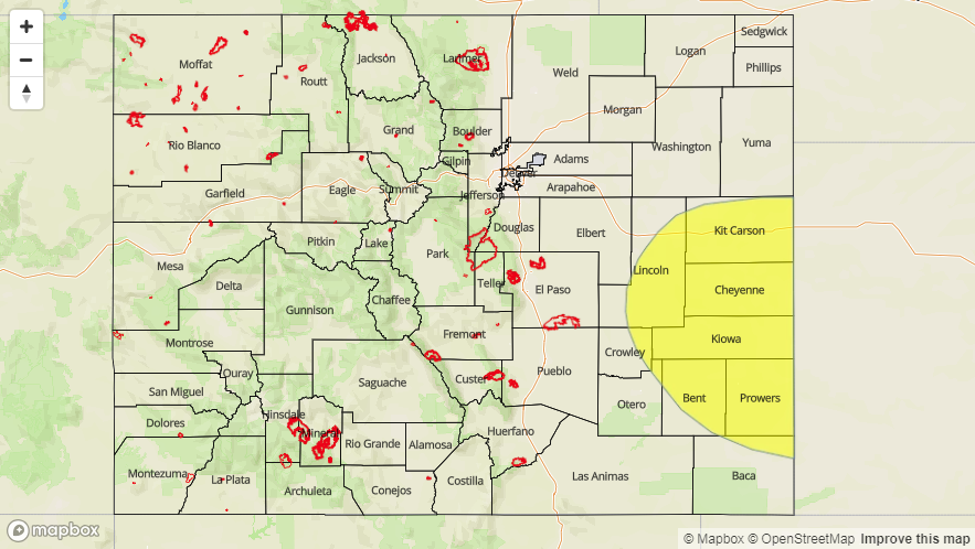
Today’s Flood Threat Map
For more information on today’s flood threat, see the map below. For Zone-Specific forecasts, scroll below the map.

Zone-Specific Forecasts:
Palmer Ridge, Front Range, Urban Corridor, Northeast Plains, Southeast Plains, Raton Ridge, Southeast Mountains:
Upslope flow will return to the region favoring the Front Range, which should initiate thunderstorms over the higher terrains by this afternoon. Max 1-hour rain rates up to 0.75 inches/hour are possible near the CO/WY/NE border. However, the higher totals are expected to stay north of Colorado. Further south over the Palmer Ridge max 1-hour rain rates up to 0.6 inches/hour are likely. Due to limited low level moisture over the Southeast Plains, the storms that fire along the Raton Ridge will only have 1-hour rain rates up to 0.3 inches/hour. Storms will move east of Colorado by 11PM.
Primetime: 2PM – 11PM
San Luis Valley, San Juan Mountains, Northern Mountains, Southwest Slope, Grand Valley, Central Mountains, Northwest Slope:
Dry thunderstorms this afternoon will lead to critical fire conditions as they will produce lightning and gusty outflow winds (45-60 mph range). Thus, a Red Flag Warning is in effect until 9PM tonight. Max 1-hour rain rates this afternoon will be in the 0.05-0.15 inches/hour range with the highest rain rates over the southern/central mountains. After 10PM, the low levels will begin moisten as the subtropical moisture reaches the southwest corner of the state. This will increase rainfall coverage and intensity overnight in western Colorado with the most widespread activity over the San Juan Mountains. Totals over the San Juans by tomorrow morning will be in the 0.25-0.4 inch range favoring the south facing slopes. Flooding is not expected overnight, but please tune back into the FTB tomorrow morning as a Flash Flood Watch has been issued for Saturday over the San Juan Mountains and 416/Burro burn scars.
Primetime: 12:30PM – 11AM