Issue Date: Friday, July 13, 2018
Issue Time: 08:40AM MDT
— A MODERATE flood threat has been issued for the Burro and 416 burn areas
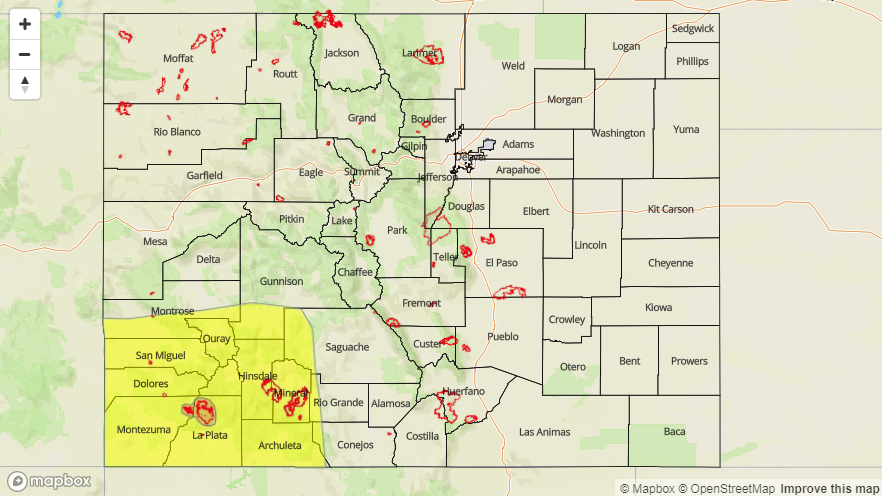
— A LOW flood threat has been issued for the Southwest Slope and San Juan Mountains
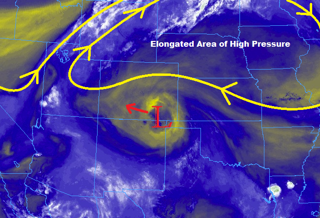
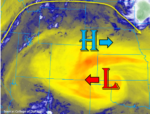
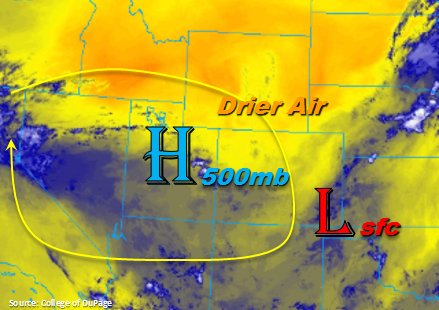
The upper level high pressure system will begin to build back to the west of Colorado today. This will pull down dry air from Wyoming due to the upper level winds having more of a northwesterly component. Over the southwest corner of the state, the upper flow will be a bit more easterly due to the location of the high. This will keep a bit more moisture over the San Juan Mountains where thunderstorms should be the most abundant this afternoon. Currently, there is some light fog over the Northeast Plains, but this is expected to burn off quickly with the entrainment of the low-level, dry air and morning heating.
Over eastern Colorado, afternoon storms should be restricted to the mountains and immediate adjacent plains. With storm motion similar to yesterday, expecting a few showers to move over northern Colorado that fire over the Cheyenne Ridge. The other area of greatest convection will be along the Front Range and where this intersects with the Palmer Ridge. Over the Southeast Mountains, storms will be more isolated when compared to yesterday. Storms that initiate near fresh burn areas (particularly Spring Creek) will need to be monitored closely. However, the threat for local, heavy rainfall is lower today. With the low-level dry air continuing to lower surface dew points, the main threats today will be gusty winds, cloud-to-ground lightning and brief rainfall.
Similar to the east, the western mountains will be entraining dry air from the north. This should limit the coverage and intensity of thunderstorms over the Northern and Central Mountains this afternoon. As mentioned above, subtropical moisture will remain over the southwest corner of the state including the San Juan Mountains. Paired with slow steering winds, there is the possibility of another afternoon of local, heavy rainfall. While intensity should decrease a bit from yesterday, the prior few days of rainfall will make runoff more likely. A Low flood threat has been issued for this area with a Moderate flood threat for the Burro and 416 burn areas. Threats include mud flows, debris slides over the higher terrains and local stream flooding over all locations in the threat area. Without much upper level forcing, thunderstorms activity should drop off quickly after sundown as instability decreases. A few showers may linger into the night, but the intensities will be below flood threat thresholds.
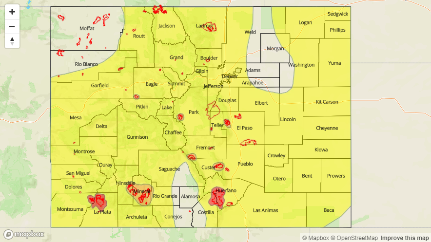
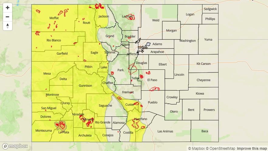
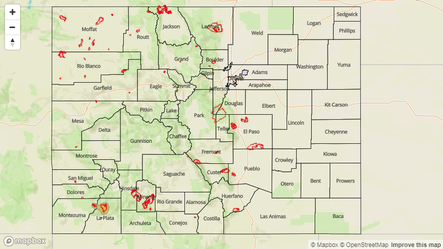
Today’s Flood Threat Map
For more information on today’s flood threat, see the map below. For Zone-Specific forecasts, scroll below the map.

Zone-Specific Forecasts:
Northern Mountains, Southwest Slope, Grand Valley, Central Mountains, Northwest Slope, San Juan Mountains, San Luis Valley:
Showers and thunderstorms will be most abundant over the San Juan Mountains and Southwest Slope this afternoon. Still expecting some storms over the Central and Northern Mountains, but they should be isolated. Over this area, max 1-hour rain rates up to 0.5 inches/hour are possible. Further south, max 1-hour rain rates up to 1.1 inches/hour are possible. There is high confidence thunderstorms over the south will have rain rates greater than 0.5 inches/hour, so a Moderate flood threat has been issued for the recent burn scars. If a storm tracks directly over the scars, this should be enough to trigger mud flows and debris slides. Elsewhere over the San Juans and Southwest Slope, increased runoff and 1 hour rainfall intensities will warrant a Low flood threat. The flood threat should end a couple of hours after sundown.
Primetime: 1PM to 9PM
Front Range, Urban Corridor, Palmer Ridge, Southeast Mountains, Raton Ridge, Southeast Plains, Northeast Plains:
Expecting thunderstorms and showers over the higher terrains again this afternoon. Dry air will continue to be pulled in from the north, so this should limit rainfall rates. To the north, max 1-hour rain rates up to 0.4 inches/hour are possible. Some rainfall may occur at the Palmer Ridge/Front Range intersect. Max 1-hour rain rates up to 0.5 inches/hour are possible here. Storms that track near the Spring Creek burn area should be monitored closely this afternoon as 0.5 inches/hour can trigger mud flows and debris slides over recent burn scars. A few showers may linger over the Southeast Mountains into the night, but flooding is not expected today.
Primetime: 2PM to 10PM