FTB 08-26-2018: Hot with a Few Showers and Thunderstorms

Issue Date: 8/26/2018
Issue Time: 9:15 AM

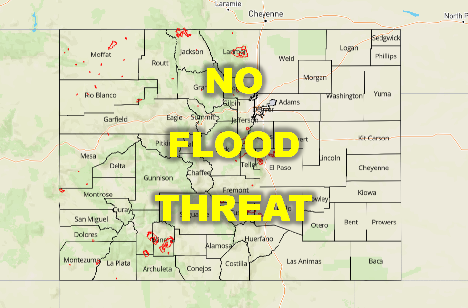
NO FLOOD THREAT IS FORECAST TODAY.

As the upper-level trough shifts across the Northern Rockies, west-southwesterly flow aloft will be in place above Colorado today. The trough will provide some broad support for another day of isolated-to-scattered showers and thunderstorms, but drier air embedded within that flow means that coverage will be less than yesterday. The High Country, with its additional orographic support, will see the best coverage of showers/storms today, in the scattered category, while east of the mountains will be more isolated. Even with showers and thunderstorms in the forecast, the drier air, combined with relatively quick storm motions to the east-northeast, will leave Colorado with no flood threat for today. Localized areas of street ponding in urban and low-lying areas cannot be ruled out from areas impacted by a brief period of moderate rainfall, but will amount to nothing more than a slight nuisance. For more details on timing and rain rates, please see the zone-specific forecast discussions below.

Today’s Flood Threat Map

For more information on today’s flood threat, see the map below (hover over threat areas for more details). For Zone-Specific forecasts, jump below the map.

Flood Threat Legend

Zone-Specific Forecasts

Urban Corridor, Palmer Ridge, Northeast Plains, Southeast Plains, and Raton Ridge:

Above normal temperatures and isolated-to-widely scattered showers and thunderstorms are expected. There isn’t as much moisture to work with as yesterday, so expect storms to produce plenty of wind and spotty rainfall. Rain rates will generally be less than 0.1 inches/hour, with maximum rates of 0.2-0.35 inches/hour west of I-25 and 0.3-0.5 inches/hour east of I-25.

Timing: 1 PM – 11 PM, with a couple lingering thunderstorms into the overnight hours thanks to a secondary, weak disturbance

Northern Mountains, Northwest Slope, Front Range, Central Mountains, Grand Valley, Southeast Mountains, San Juan Mountains, Southwest Slope, and San Luis Valley:

Scattered showers and thunderstorms expected today and tonight, moving at a decent clip to the east-northeast. The best coverage will occur south of I-70 once again, with the higher terrain of the Southwest Slope, San Juan Mountains, Grand Valley, and Central Mountains being the big “winners,” so to speak. Rain rates will generally be less than 0.1 inches/hour, with maximum rates of 0.2-0.4 inches/hour.

Timing: 11 AM – 2 AM, with a couple lingering showers/weak thunderstorms until daybreak on Monday

FTB 08-25-2018: Moisture Returns to Colorado

Issue Date: 8/25/2018
Issue Time: 9:05 AM

A LOW FLOOD THREAT IS FORECAST TODAY FOR PORTIONS OF THE SOUTHWEST SLOPE, SAN JUAN MOUNTAINS, SOUTHEAST MOUNTAINS, RATON RIDGE, AND SOUTHEAST PLAINS.

The approach of an upper-level trough from the west (and associate disturbances denoted by red dashed lines) has forced the upper-level ridge eastward, placing Colorado squarely underneath southwest flow aloft for today/tonight. This has allowed precipitable water to tick upwards to near, or slightly above, 0.75 inches across the state. This moisture, although confined mainly in the mid-levels, will provide the fuel for showers and thunderstorms today and tonight across the state, with the best coverage south of I-70 coinciding with the best low-level moisture, relatively speaking.

With all of that said, moisture below cloud bases still lacks, so the threat of heavy rainfall is fairly marginal today. Plus, storm motions will be moving at a decent rate to the east-northeast, so it will be difficult for storms to produce rainfall above flash flood thresholds. Despite these factors, a low flood threat has been issued, mainly for the sensitive burn scars in southern Colorado. Multiple rounds of marginally heavy rainfall may be enough to set off these areas, so the low threat is warranted. For more details on timing and rain rates, please see the zone-specific forecast discussions below.

Today’s Flood Threat Map

For more information on today’s flood threat, see the map below (hover over threat areas for more details). For Zone-Specific forecasts, jump below the map.

Flood Threat Legend

Zone-Specific Forecasts

Urban Corridor, Palmer Ridge, Northeast Plains, Southeast Plains, and Raton Ridge:

Isolated-to-scattered showers and thunderstorms expected, with the best coverage south of I-70. Dry air below cloud bases will keep rain rates fairly low, especially along/near the higher terrain. Further east, near the eastern CO border, a bit more low-level moisture will be present, allowing a couple thunderstorms to become strong-to-severe, producing brief periods of heavy rain, strong winds, and plenty of lightning. Maximum rain rates are as follows:

Urban Corridor and Palmer Ridge: 0.1-0.3 inches/hour
Raton Ridge: 0.2-0.35 inches/hour
Southeast Plans and Northeast Plains: 0.6-1.1 inches/hour

Timing: 1 PM – 11 PM, with a couple isolated showers/storms lingering into the early morning hours over the Southeast Plains and Raton Ridge

Northern Mountains, Northwest Slope, Front Range, Central Mountains, Grand Valley, Southeast Mountains, San Juan Mountains, Southwest Slope, and San Luis Valley:

Scattered showers and thunderstorms are expected today/tonight, with the first storms of the day popping over the San Juan Mountains and Southwest Slope by 11 AM. Storm motions and dry air below cloud bases will keep most rain rates light, especially for areas north of I-70. The best chance at heavy rainfall will be over the San Juan Mountains, Southwest Slope, and Southeast Mountains, where low-level moisture is best, relatively speaking. The low flood threat is warranted due to the possibility of multiple rounds of thunderstorms in these areas. Maximum rain rates are as follows:

Northwest Slope and Grand Valley: 0.05-0.2 inches/hour
Northern Mountains, Front Range, and Central Mountains: 0.1-0.35 inches/hour
Southwest Slope, San Juan Mountains, and San Luis Valley: 0.4-0.6 inches/hour
San Luis Valley and Southeast Mountains: 0.25-0.5 inches/hour

Timing: Noon – 10 PM for locations north of I-70; 11 AM – Midnight for locations south of I-70, with a couple isolated showers/weak thunderstorms lingering over the San Juan Mountains and Southeast Mountains into the early morning hours.

FTB 08-24-2018: Isolated Storms for Western Colorado as Next Trough Digs in Over the West Coast

Issue Date: Friday, August 24th, 2018
Issue Time: 08:40AM MDT

— Flooding is NOT expected today

Visible satellite shows mostly clear skies with a little fog over southern Colorado to start the day. The smoke is also still here, which is heaviest over eastern Colorado along the Urban Corridor. Guidance shows the near-surface smoke increasing over this area quite a bit throughout the day. There is also an Air Quality Health Advisory this morning for northwestern Colorado.

Today the weak ridge over Utah will slide eastward as the next trough begins to dig south over the west coast. After the ridge passes, some upper-level energy on its back side will help promote some light showers and thunderstorms over western Colorado later this afternoon. Flow aloft will also become more southwesterly this afternoon after the ridge passes to the east. While the southwest flow will begin to increase the subtropical moisture overnight, low-level moisture for the storms this afternoon will be lacking. This translates to storms today likely producing gusty winds with limited rainfall totals. To the east, downsloping winds will continue to scour out any residual moisture under the ridge. This will make it quite difficult for any storms to fire over the higher terrains today.

Today’s Flood Threat Map

For more information on today’s flood threat, see the map below. For Zone-Specific forecasts, scroll below the map.

Zone-Specific Forecasts:

Grand Valley, Central Mountains, San Juan Mountains, San Luis Valley, Southwest Slope, Northern Mountains, Northwest Slope, Northeast Plains:

Weak showers and a possible thunderstorm or two this afternoon are possible over western CO as the trough digs in over the west coast. Flow will turn more southwesterly aloft this afternoon as well. This may help bring a little low-level moisture back, but the moderate monsoon surge won’t occur until tomorrow. Thus, storms today are not expected to be widespread in coverage. Max 1-hr rain rates up to 0.2 inches are possible with gusty outflow winds likely under the stronger cores. Flooding is not expected today.

Primetime: 2PM – 9PM

Southeast Plains, Raton Ridge, Southeast Mountains, Front Range, Palmer Ridge, Urban Corridor:

Downsloping winds and resulting subsidence will continue today, which will scour out most of the residual moisture under the ridge. Weak upslope flow may set up this afternoon, but this would only increase cloud cover over the higher terrains. High temperatures should bump up a couple degrees from yesterday. Visibility is expected to deteriorate throughout the day along the I-25 Corridor. The Front Range Air Quality forecast has an Action Day, which means air quality will once again be unhealthy for sensitive groups.

FTB 08-23-2018: Drier, Hotter, and Smokier for Most, with just Isolated Storms South

Issue Date: Thursday, August 23rd, 2018
Issue Time: 09:40AM MDT

— NO flood threat today.

After sponsoring a round of showers and thunderstorms across the northwestern portion of the state last night, an upper-level trough over Wyoming is now quickly moving off to the east. Moisture is starting off high ahead of this feature in many areas today (approaching the 90th percentile values for August 23rd at both Grand Junction and Denver), but the back (west) side of the trough will usher in predominantly subsident air. Subsidence produces warming and drying and will also help suppress any convection that attempts to develop this afternoon; this is evident in this morning’s lower-level water vapor imagery, which shows that the trough axis divides a starkly drier airmass to the northwest from the moist monsoon flow to the south.

While the trough is progressing to the east fairly rapidly, it may take much of the day for dry air to take hold across the southern 1/3 or so of the state. Where above-average moisture lingers, a few storms are possible, particularly across the high terrain. With a predominantly subsident airmass and storm motions of 20-30 mph, storm coverage is expected to be limited and they should move to the east or east-southeast at a sufficient rate to avoid flood concerns. Any storms that do develop may be capable of producing brief gusty winds, but a substantial severe weather threat is not expected today.

Today’s Flood Threat Map

For more information on today’s flood threat, see the map below. For Zone-Specific forecasts, scroll below the map.

Zone-Specific Forecasts:

Northwest Slope, Northern Mountains, Grand Valley:

Showers that lingered from last night’s area of rain have faded out as of the forecast issuance time. Sunny but smoky skies are expected for the rest of the day, with some fair-weather cumulus possible over the mountains later in the afternoon. No additional notable rainfall is expected.

Southwest Slope, San Juan Mountains, Central Mountains, San Luis Valley, Southeast Mountains, Raton Ridge, Southeast Plains:

Some cloud cover is present across mountainous areas this morning, but skies may be expected to generally clear. Isolated storms may develop this afternoon, primarily in the higher terrain, moving east-southeastward at 20-30 mph. Rainfall rates should primarily be just 0.10-0.20 inches per hour or less. An isolated late-evening storm is also possible on the eastern plains. Smoke blowing in from the west-northwest is also expected to increase this afternoon and evening.

Primetime: 12PM to 10PM

Front Range, Urban Corridor, Palmer Ridge, Northeast Plains:

Areas of clouds this morning are expected to decrease throughout the day as drier air aloft moves in. Smoke will also become more prominent, however, so hazy skies and deteriorating air quality should be expected as well. Temperatures should be right around seasonal averages, with highs in the mid-80s °F on the plains.