FTB 07-10-2019: Weak Thunderstorms Over the Southeast Quadrant of the State

Issue Date: Wednesday, July 10, 2019
Issue Time: 9:55AM MDT

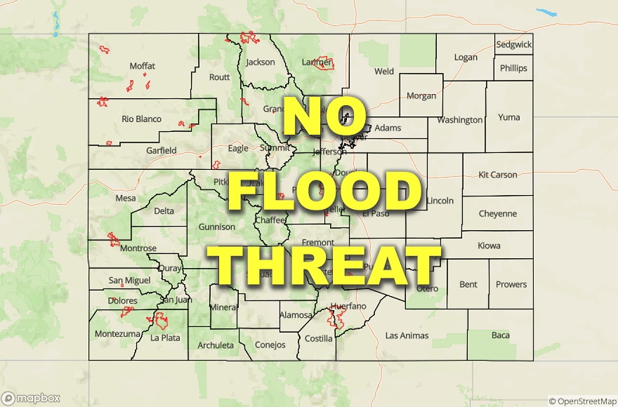
Flooding is NOT expected today

The ridging pattern aloft has continued to strengthen and is centered over Colorado this morning. Upper level flow is not expected to change much today, but low level and surface features will provide chances for afternoon and evening thunderstorms. The majority of state, west of the Continental Divide, will remain dry today as westerly and southwesterly flow aloft continues. The surface high pressure that was centered over the area yesterday has shifted to the north, allowing for moderate moisture advection and upslope flow to occur by midmorning over the southeastern portion of the state. A cold front (blue line below) moved over the eastern plains last night and into this morning, which has provided cloud cover over the Southeast Plains. Although clouds are likely to burn off by noon, cloud cover this morning will prevent moisture from mixing out rapidly, with dewpoints expected to stay in the 50°Fs throughout the region. Moisture to the north of the cloud cover will mix out and combine with downslope flow in the northern half of the state, which will limit chances for rainfall. Moisture over the eastern plains is moderate, with PW measurements increasing to the east of the foothills from 0.5 to 1.2 inches over the CO/KS border.

The high pressure system centered over the CO/WY border is expected to move eastward throughout the day, advecting warm, moist air into the southeast quadrant of the state. Mid-level flows behind the surface high are forecast to generate a vorticity maximum over the Southeast and Central Mountains (marked with an “X” below), which will combine with upslope flow to produce afternoon thunderstorms over the Raton Ridge, Central and Southeast Mountains. Storms are forecast to move off of the mountains and over the Southeast Plains later tonight and into tomorrow morning.

Riverine: As of 9:30 this morning there are no NWS Flood Warnings or Flood Advisories.  AHPS gages remain at Action stage on the Arkansas at La Junta and the Rio Grande near Alamosa due to dam releases.  To track new Flood Advisories from dam releases, tune into your local NWS office.

Today’s Flood Threat Map

For more information on today’s flood threat, see the map below. For Zone-Specific forecasts, scroll below the map.

 Zone-Specific Forecasts:

Central Mountains, Southeast Mountains, Raton Ridge, Front Range, Urban Corridor, Southeast Mountains, and portions of the Palmer Ridge and Northeast Plains

Upslope flow and a passing vorticity maximum will provide lift for thunderstorms over the Central and Southeast Mountains, Raton Ridge, and southern portion of the Front Range.  Rainfall accumulations are expected to remain low as moisture and deep upper level support is lacking.  Max 1-hr rainfall rates up to 0.3 inches is forecast over the high terrain this afternoon and into the evening.  Rain is possible over the Junkins, Spring Creek and Hayden Pass burn areas but flood inducing rainfall rates are not forecast. Thunderstorms are expected to move off of the Southeast Mountains around 10PM tonight.  Storm outflow boundaries could generate storms over the Palmer Ridge and southern portion of the Northeast Plains early tomorrow morning. Max 1-hr rainfall rates of 0.6 inches are possible over the far Southeast Plains.  Dry air over the Urban Corridor will limit accumulation over the area if storms move off of the Front Range.  Only trace amounts are expected over the area.  Flooding is not forecast for today.

Primetime: 3PM to 8AM

San Luis Valley, Northern Mountains, Northwest Slope, Grand Valley, Southwest Slope, San Juan Mountains

Advection of dry air from the west and southwest will provide mostly sunny skies and warm temperatures over the area today.  Afternoon cloud cover and brief showers are possible over the San Juan Mountains due to the incoming vorticity maximum, but max 3-hour accumulations are expected to be less than 0.15 inches.  High temperatures will reach into the mid 90°Fs over the low laying areas, and will decrease into the 70°Fs and 80°Fs over the high country.

Primetime: 4PM to 9PM
FTB 07-09-2019: Return of Dry, Warm Weather After a Wet Weekend

Issue Date: Tuesday, July 9, 2019
Issue Time: 9:45AM MDT

Flooding is NOT expected today

Clear skis and warm temperatures are expected statewide today after a week of wet weather. Upper level flow has transitioned to the west as a high pressure ridge builds over the southwest United States. This will bring in dry, hot air from the west and southwest shown in yellow in the water vapor imagery below. At the surface, a broad area of high pressure has set in, which will prevent moisture advection from the south and east. Dewpoints this morning have dropped significantly over the western half of the state and high country, with measurements in the 30°Fs over the western border and decreasing into the teens over the Central Mountains. Large scale subsidence and down sloping winds throughout the day will mix out moderate to high levels of residual moisture over the eastern plains. There is a slight chance for afternoon thunderstorms along the northern border of the state as a shortwave (marked with an “X” below) and left entrance region of a jet streak pass over Wyoming this afternoon and tonight. Dry air in the low levels is forecast to limit accumulation to trace amounts, with the primary threat being gusty winds.

Riverine: As of 9:30AM this morning there are no NWS Flood Warnings. There is a flood advisory currently in effect for the Roaring Fork River near Aspen in Pitkin County. Minor lowland flooding is possible along the river, with snowmelt increasing as temperatures warm up this week. AHPS gages remain in action stage on the Arkansas River at La Junta, the Rio Grande near Alamosa, and the Blue River below Dillon as dam releases continue. Water levels remain high in the Platoro and Terrace Reservoirs in Conejos Country. Minor lowland flooding is possible along the Conejos River due to dam releases.

Today’s Flood Threat Map

For more information on today’s flood threat, see the map below. For Zone-Specific forecasts, scroll below the map.

Zone-Specific Forecasts :

Northern Mountains, Front Range, Urban Corridor, Palmer Ridge, Northeast Plains, Southeast Plains, Southeast Mountains, Raton Ridge

Chances of precipitation are very low today and confined to the northern border of the forecast area. A cold front associated with the shortwave passing over Wyoming this afternoon will provide a small chance of lift and weak afternoon storms. Moisture will mix out throughout the day due to down sloping winds and advection of dry air from the west. Accumulation is forecast to be from a trace to 0.05 inches. Dry air underneath the storm could cause virga, making the primary threat over the area wind gusts up to 30 mph. High temperatures will reach into the upper 90°Fs over the southeast, with highs in the upper 80°Fs over the northeast quadrant, and 70°Fs and 80°Fs over the low laying areas of the high country.

Primetime: 3PM to 8PM

Northwest Slope, Grand Valley, Central Mountains, Southwest Slope, San Juan Mountains, San Luis Valley

The area is going to dry out quickly today, with dewpoints expected to drop into the single digits over the southwest quadrant of the state. Clear skies and warm temperatures are forecast for today with little to no chance of precipitation. Winds are forecast to be calm underneath the large zone of high pressure. High temperatures in the mid 80°Fs are expected over most of the area, with the Grand Valley reaching into the mid 90°Fs.

FTB 07-08-2019: Heavy Rainfall Forecast for the Northeast Plains

Issue Date: Monday, July, 8th, 2019
Issue Time: 9:10AM MDT

–A LOW flood threat is issued for the Northeast Plains and portions of the Raton Ridge and Southeast Plains

The water vapor imagery below is very active out in front of the upper trough, which is forecast to begin  to move east throughout the day. This will increase southwest and then westerly flow over the state this afternoon into the overnight hours. Over the southwest corner of the state, dry air will begin to be advected into the area, which should keep storm activity more isolated over western Colorado this afternoon. This will limit the higher accumulations to along and near the Continental Divide. Over eastern Colorado, southeasterly winds at the surface will hold moisture in place over the eastern plains. A low over the Southeast Plains will cause downsloping winds at the surface over the Southeast Mountains, so this should mix out moisture over the immediate adjacent plains. ENE movement of the storms at 15-20 knots paired with limited moisture over the mountains and immediate adjacent plains should limit the flood threat over these regions. As far as coverage, with strong lift out in front of the trough, storms this afternoon are expected to be more widespread than the last couple of days.

With dew points in the 60°Fs over the Northeast Plains, slower steering winds and trailing storms possible, heavy rainfall is forecast beginning later this afternoon and last through this evening. Building instability over the area, as clouds begin to break up, will likely cause storms to intensify as they move into the area. Some severe storms are forecast thanks to weak shear from southeasterly surface winds. The main threats from the storms will be brief, strong winds, hail up to 1.75 inches, field ponding and flooding of low lying roadways. A Low flood threat has been issued.

Riverine:

As of 9AM this morning there are no NWS Flood Warnings. However there are Flood Advisories for the Blue River below Dillion and for the Roaring Fork River near Aspen from recent dam releases and decreasing water diversions. Minor lowland flooding can be expected over these areas through at least the middle of the week. Warm temperatures in the forecast will also add some more runoff from snowmelt. As far as AHPS gages in Action Stage, the Rio Grande continues to remain elevated, although flows are forecast to decrease the next couple of days across the SLV. The Avondale and La Junta gages along the Arkansas River are also at Action stage, so Minor lowland flooding will be possible. There have been some rises along the South Platte River thanks to recent rainfall over the Northeast Plains, but flooding is not anticipated along the river. Please follow your local NWS office as they will update flood products throughout the day.

Today’s Flood Threat Map

For more information on today’s flood threat, see the map below. For Zone-Specific forecasts, scroll below the map.

Flood Threat Legend


Zone-Specific Forecasts:

Northeast Plains, Palmer Ridge, Front Range, Urban Corridor, Southeast Mountains, Raton Ridge, Southeast Plains:

Storms this afternoon will favor the Front Range, Palmer Ridge and Raton Ridge for initiation from upslope flow. Drier air and swift steering winds over the Southeast Mountains should keep burn areas safe from flooding issues this afternoon. Over the mountains and adjacent plains, max 1-hour rain rates up to 0.45 inches will be possible. Moving east to the Northeast Plains and eastern Palmer Ridge, max 1-hour rain rates up to 1.75 inches will be possible due to higher moisture, slower steering winds and trailing storms. Isolated storm totals up to 2 inches may be possible. Storms that form over the Raton Ridge and move into the southeast corner counties could produce 1-hour rain rates up to 1 inch. A Low flood threat has been issued with the flood threats being localized flash flooding, field ponding and flooding over low lying roads.

Primetime: 1:30PM to 10PM

Northwest Slope, Grand Valley, Southwest Slope, Northern Mountains, Central Mountains, San Juan Mountains, San Luis Valley:

Southwesterly flow is forecast to increase today and turn more westerly into tonight. Surface winds will increase this afternoon as well (southwest) with the approaching trough tightening the pressure gradient. This will begin to pull a drier air mass into the state and decrease PW values. There will be enough residual moisture today for another round of storms over the mountains, but with more isolated coverage. Highest accumulations will be along and near the Divide. Max 1-hr rain rates up to 0.2 inches will be possible over this area. Storms will likely produce gusty outflow winds, so brief gusts in the in the 40 to 50 mph will be likely again today.

Primetime: 1PM to 8:30PM

FTB 07-07-2019: Rain Returns to the High Country, Low Flood Threat Issued Over Burn Areas

Issue Date: Sunday, July, 7th, 2019
Issue Time: 10:15AM MDT

A LOW flood threat is forecast today over the 416, Spring Creek, and Hayden Pass burn areas

The weak high pressure ridge aloft that influenced our weather yesterday has not moved at all and remains a major feature across the central United States.  Southwesterly flow aloft (yellow line) will bring in mid and upper level moisture from the Pacific and Southerly flow in the low levels will bring in warm temperatures and moisture from the Gulf.  Embedded within the flow is a shortwave (marked with an “X” below) that will aid moderate to high moisture levels in producing afternoon and early evening thunderstorms over the high country and eastern plains.  Westerly flow aloft over the northern half of the state will limit rainfall totals over the northern areas of the high county.  Cloud cover and fog over the eastern plains is expected to burn off this morning, which will increase instability over the area throughout the morning and into the early afternoon.  PW measured in Denver this morning is 0.83 inches, providing chances for moderate rainfall.

A surface low is forecast to form in central Colorado midday.  This feature will create convergence over the southern Urban Corridor and Palmer Ridge, which will aid thunderstorm generation over the area.  Downslope flow on the backside of the low will limit chances for thunderstorms over the Southeast Plains and areas adjacent to the foothills.  Storm motion west of the continental divide will be quick enough to limit chances of heavy precipitation over the area.  Over the eastern plains storm motion will be much slower, allowing for moderate rainfall near the Kansas border.

Riverine: There are currently no flood warnings this morning (as of 10AM), although rivers and streams remain elevated in the high country and Arkansas River valley.  There is a possibility of more dam releases, which will increase the chances of flooding of low laying areas.  There are currently flood advisories in effect for: the Roaring Fork River near Aspen, and the Blue River below Dillon.  Please use caution near swift moving waters.   Additionally, we have had reports of high flows within the SLV along the Conejos and Rio Grande River with Platoro and Terrace Reservoirs looking very full as well.  Along the Arkansas River gages at Avondale and La Junta are at Action stage.  Unless there is a dam release from the Pueblo Reservoir today, these areas should remain below minor flood stage.

Today’s Flood Threat Map

For more information on today’s flood threat, see the map below. For Zone-Specific forecasts, scroll below the map.

Flood Threat Legend


Zone-Specific Forecasts:

Southwest Slope, San Juan Mountains, Southeast Mountains, Raton Ridge, Central Mountains, San Luis Valley

Passage of a shortwave and upslope flow of moist air from the south will provide chances for moderate thunderstorms this afternoon and into the early evening.  A Low flood threat is issued for the 416, Spring Creek, and Hayden Pass burn areas.  Max 1-hour rain rates of 0.4 inches and max 3-hour rain rates of 1 inch could cause issues over the burn areas.  Threats over these areas include flash flooding, mud flows and debris slides.  Steering winds up to 25 mph will limit heavy, long duration rainfall over the area.  Thunderstorms are expected to be confined over upper elevations, but brief rainfall over the valleys is possible.

Primetime: 2PM to 12 AM

Grand Valley, Northwest Slope, Northern Mountains, Front Range, San Luis Valley

Westerly upper level flows have limited moisture advection into the area.  Brief, isolated thunderstorms are possible, with max 1-hour accumulation of 0.25 inches.  Wind gusts up to 30 mph can be expected within the storm vicinity.  Flooding is not expected today.

Primetime: 2PM to 1AM

Urban Corridor, Northeast Plains, Palmer Ridge, Southeast Plains

Surface moisture remains high today, with dewpoints measuring in the 50°Fs and low 60°Fs this morning.  Convergence along the Palmer Ridge is forecast to produce moderate to severe thunderstorms this afternoon and into the evening.  As storms move into the far eastern plains, increased moisture and slow steering winds will produce moderate rainfall.  Max 1-hour rain rates of 1 inch are possible over the Palmer Divide.  Max 3-hour rain rates up to 2 inches are possible, but drying of the soil yesterday should prevent flooding.  No flooding is forecast over the area today.

Primetime: 3PM to 4AM