Issue Date: Thursday, August 15th, 2019
Issue Time: 8:35AM MDT
— Flooding is NOT expected today
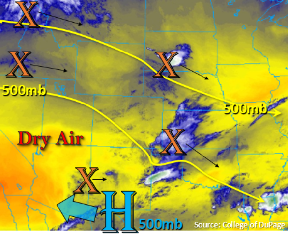
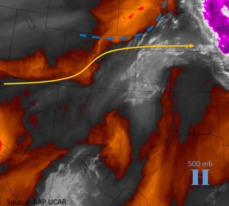
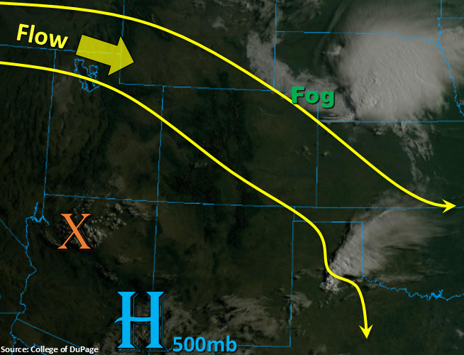
There’s a break in severe thunderstorms and heavy rainfall forecast for Thursday as northwest flow ushers in a dry air mass. This dry air can be seen by the cloud free skies over Utah and Wyoming in the visible satellite imagery below. PW values have dropped off both east and west of the Continental Divide as forecast in the FTO. This morning’s sounding measured Denver’s PW at 0.59 inches and Grand Junction’s PW at 0.51 inches, which is well below average for this time of year. Most of the remaining low level moisture east of the Divide will mix out from west to east throughout the day. While there will be some higher moisture and CAPE values along the Colorado border, it doesn’t look like there will be any disturbances to help break the cap. Also forecasting the dense fog over the Northeast Plains to dissipate with a little more morning heating.
As far as storm potential today, a couple high-based, isolated, weak storms are forecast with residual moisture under the ridge over the eastern San Juan Mountains. Some heftier cloud cover will also occur over the Northwest Slope by late this afternoon, but only a drop or two of rainfall is forecast. There is a 20-30% chance for an isolated storm or two over the far Southeast Plains along the CO/KS border, but rainfall totals should remain below 0.20 inches. Flooding is not forecast.
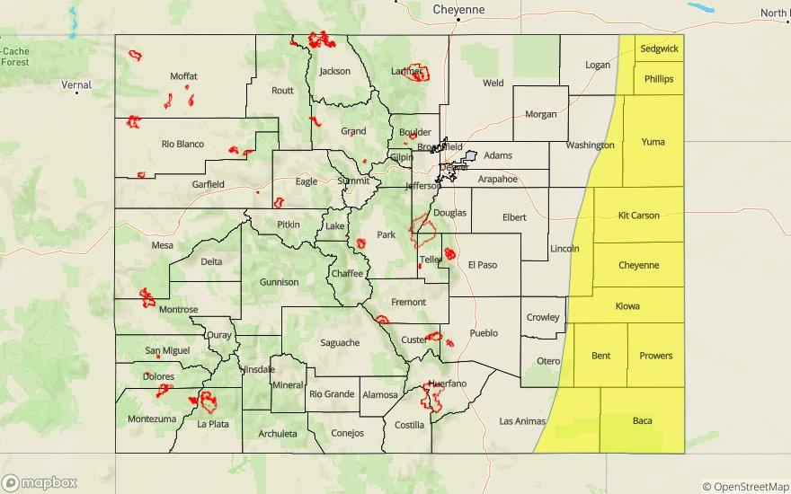
Today’s Flood Threat Map
For more information on today’s flood threat, see the map below. For Zone-Specific forecasts, scroll below the map.
Zone-Specific Forecasts:
Northwest Slope, Southwest Slope, Grand Valley, Northern Mountains, Central Mountains, San Juan Mountains, San Luis Valley:
Best chance for storms today will be over the eastern San Juan Mountains. Without much changing in the way of forcing and moisture from yesterday, thinking totals for rainfall will be under 0.10 inches. Additional cloud cover will move into the Northwest Slope later this afternoon, which should provide some relief from the heat. High temperatures over the lower valleys will be in the upper 90°Fs with low 90Fs over the mid-level elevations. Flooding is not forecast.
Primetime: 2PM to 8PM
Front Range, Southeast Mountains, Raton Ridge, Palmer Ridge,Urban Corridor, Northeast Plains, Southeast Plains:
Another day with seasonable high temperatures. The northeast corner of the state might be a little bit cooler than the Southeast Plains, but 90°Fs are forecast across all lower elevations. Storms that form over the Southeast Plains will produce under 0.20 inches, so flooding is not forecast. There is an MCS that forms over the NE panhandle tonight, so this may cause another round of fog tomorrow morning over the northeast corner of the state.
Primetime: 3PM to 9PM