Issue Date: Friday, May 1st, 2020
Issue Time: 8:25AM MDT
— Flooding is NOT expected today
Welcome back to the FTB! We’re looking forward to a successful 2020 season serving you.
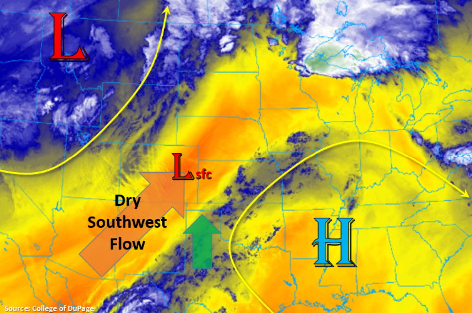
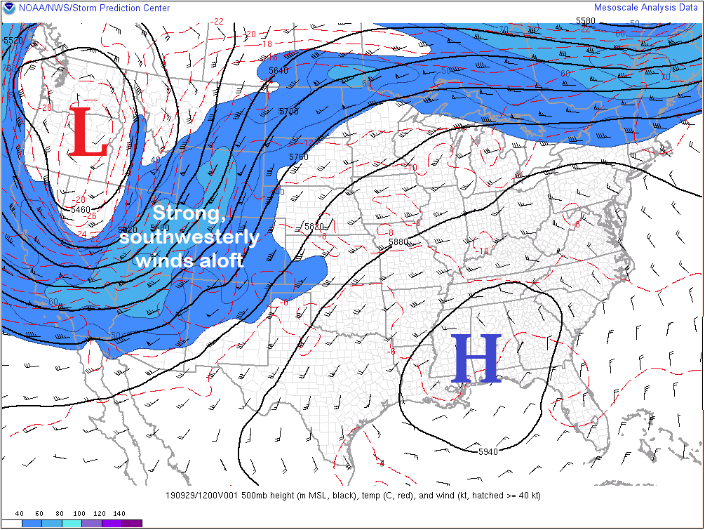
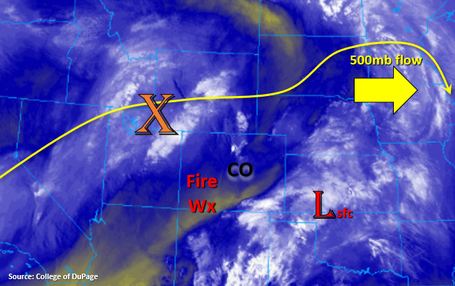
Another warm day is on tap for the state to kick off the 2020 FTB season, so be sure to get outside and enjoy the sunshine! Seen (to our east) in the mid-level water vapor imagery below is the surface low and upper ridge that controlled yesterday’s weather. The next system is already lined up behind it, which is marked with the orange “X”. There is minimal residual moisture in the wake of yesterday’s system, so as this system moves west to east throughout the day, it will provide some lift for scattered showers over northern Colorado.
Again, not much in the way of moisture, so expect more gusty winds than accumulating rainfall due to the large spread in temperature and dew point. A cold front will drop in from the north this evening, which will usher in cooler temperatures tomorrow and increase thunderstorm chances over the northern Urban Corridor and Northeast Plains late this afternoon and evening. A stray thunderstorm or two may also be possible over the eastern Palmer Ridge as the front dips south and more moisture becomes available. Expect northerly winds to pick up along the front and gusty outflow winds under the storm bases. Flooding is not expected with the storms that develop today.
Different story for areas south of I-70 where a deepening surface low and a very dry atmosphere will combine for pockets of critical fire weather. Once again, a Red Flag Warning has been issued for the Grand Valley and San Luis Valley. Expect winds to pick up from the west/southwest by mid-afternoon through about 8PM tonight.
Today’s Flood Threat Map
For more information on today’s flood threat, see the map below. Hover over the threat areas for more details, and click on burn areas to learn more about them. For Zone-Specific forecasts, scroll below the threat map. 
Zone-Specific Forecasts:
Northwest Slope, Northern Mountains, Front Range, Urban Corridor, Northeast Plains, Palmer Ridge:
Some nice sunshine to start the day with the break between the two systems. Expect storms to pick up this afternoon over the northern Northwest Slope and Northern Mountains as the next shortwave moves into the state. Best chance for accumulation will be over Routt and Moffat Counties, although gusty wind will be likely than rainfall at the lower elevations. Max 1-hour rain rates up to 0.20 inches will be possible with most accumulations under 0.15 inches. Over northeast Colorado, rain rates up to 0.20 inches per hour (west) and 0.40 inches per hour (east) will be possible with the strongest storms that develop along the cold front. Expect only light accumulation for storms that linger into the night over the Northeast Plains. Flooding is not forecast.
Primetime: 2PM to 3AM
Grand Valley, Southwest Slope, San Luis Valley, San Juan Mountains, Central Mountains, Southeast Plains, Raton Ridge, Southeast Mountains:
It’s going to be another hot one! With the cold front dropping south this evening, some relief from the heat is on its way tomorrow. Highs could hit 90F or greater over the southern Urban Corridor and Southeast Plains, which could cause the Colorado Springs daily high temperature record to be broken. Highs will also reach the upper 80Fs over the Grand Valley. Southwest and westerly winds will pick up this afternoon, and they are expected to be in the range of 10 to 20 mph with gusts up to 30 mph. A Red Flag Warning has been issued for the San Luis Valley and Grand Valley area from 2PM to 9PM this evening.