Issue Date: Friday, May 29th, 2020
Issue Time: 10AM MDT
— A LOW flood threat has been issued for the Spring Creek burn scar in Huerfano and Castillo counties
— A LOW flood threat has been issued for the Decker burn scar in Fremont, Saguache and Chaffee counties
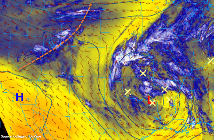
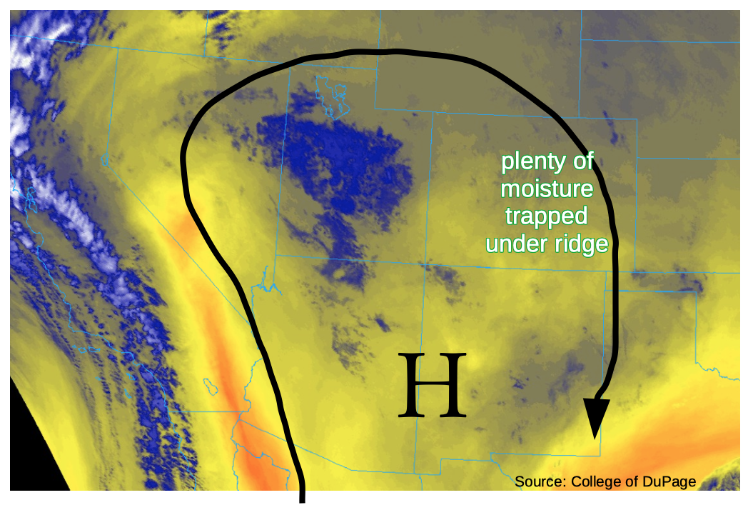
The water vapor imagery on this Friday morning, shown below, could make one think that we are in the middle of monsoon season. A very strong ridge of high pressure is situated over the Four Corners region, being reinforced by a digging trough over the eastern Pacific Ocean. This early in the warm season, such a trough would typically be associated with very hot and mostly dry weather as moisture is typically lacking. However, such is not the case today as plenty of moisture remains “trapped” under the ridge. Precipitable water (PW) was estimated at 0.67 inches at Grand Junction this morning and is in the 0.50 – 0.85 inch range across the state (the Denver sounding appears to have sampling issues in the lower levels so the PW was suspect). The average PW at Grand Junction for late May is 0.45 inches and today’s value is roughly in the 90th percentile. It is important to note that most of this moisture is actually above the boundary layer, which will limit its effectiveness in contributing to heavy rainfall today.
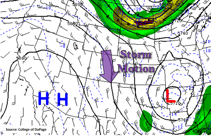
From the perspective of dynamics, there does not appear to much happening today. A weak disturbance was noted over central Utah, but due to its north-northeast trajectory, it is unlikely to influence our weather today. However, sometimes one does not need dynamics when you have topography extending to 14,000 feet! With hardly a cloud in the sky this morning, expect a quick warm-up with scattered to numerous showers and storms developing shortly after noon. The highest coverage will be in the higher terrain of the San Juans, Central Mountains, Front Range, Palmer Ridge and Raton Ridge. Wind shear profiles suggest southeast storm motions in the 20-30 mph range. Individual storms will produce short-term heavy rainfall approaching, but not exceeding flood threat levels. Small hail and gusty downdraft winds will likely accompany the strongest storms today.
The main concern today are the two fresh burn scars in the Sangre de Cristo mountains: Decker to the north and Spring Creek to the south. With storm motion paralleling the mountain range axis, there is the good chance of multiple bursts of heavy rain over a period of a few hours. High-resolution rainfall accumulation guidance suggests better coverage than yesterday, as shown below. Thus, a Low flood threat has been issued for these two scars for the afternoon and evening hours. Remember, it does not take much rain to cause dangerous debris slides and mud flows over burn scars so please pay attention to the Pueblo National Weather Service updates later today.
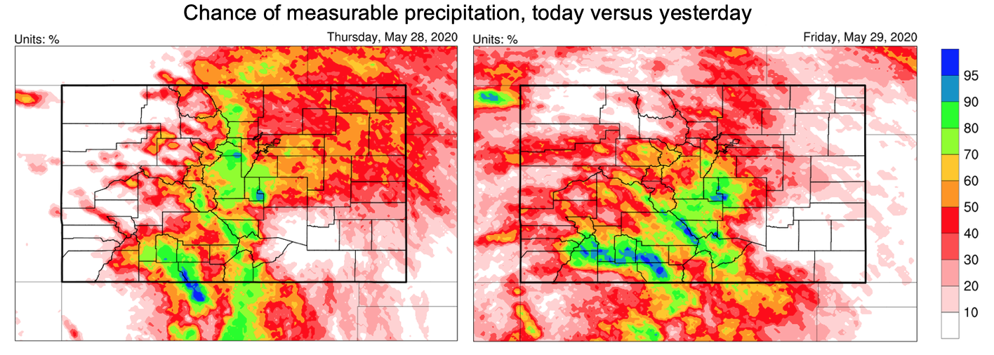
Today’s Flood Threat Map
For more information on today’s flood threat, see the map below. If there is a threat, hover over the threat areas for more details, and click on burn areas to learn more about them. For Zone-Specific forecasts, scroll below the threat map.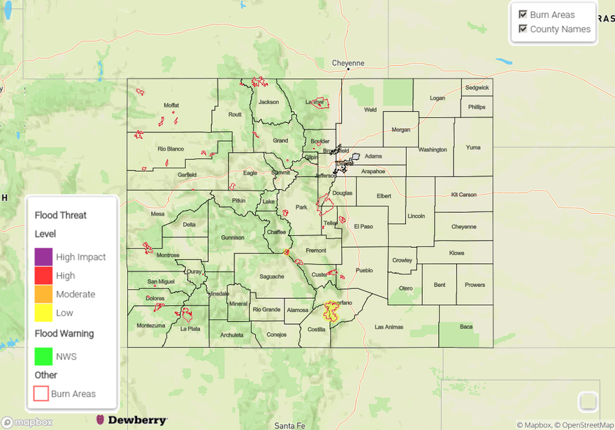
Zone-Specific Forecasts:
Urban Corridor, Front Range, Southeast Plains, Palmer Ridge, Raton Ridge, Southeast Mountains, Southeast Plains, San Juan Mountains, Central Mountains, San Luis Valley:
Sunny early then very warm with increasing cloudiness and scattered to widespread showers/thunderstorms developing by early afternoon. The highest coverage will be over the higher terrain of central and southern Colorado. Max 1-hour rainfall up to 0.8 inches, with max 3-hour rainfall up to 1.2 inches possible especially over the Palmer Ridge and Raton Ridge. Small hail and gusty winds are likely with the strongest storms. Primetime is noon through 9PM.
A Low flood threat has been issued for the Decker and Spring Creek burn areas from 1PM through 9PM today. Max 30-minute rainfall up to 0.5 inches, 1-hour rainfall up to 0.6 inches and 3-hour rainfall up to 0.9 inches could cause isolated flash flooding, debris slides and mud flows. Stay tuned to warnings from the Pueblo National Weather Service office.
Northern Mountains, Northwest Slope, Grand Valley:
Sunny early then partly cloudy and very warm is isolated to scattered showers and thunderstorms developing. Max 1-hour rainfall up to 0.3 inches. Flooding is not expected today. Gusty winds are possible with the strongest storms. Primetime for rainfall is noon through 8PM.
Northeast Plains:
Sunny early then much warmer with an isolated shower or storm possible especially over western areas. Max 1-hour rainfall up to 0.3 inches. Gusty winds are possible with the strongest storms. Flooding is not expected today. Primetime for rainfall is 2PM through 8PM.