STP 06-23-2015: High Pressure Continues To Rule The Land

Issue Date: 6/23/2015
Issue Time: 9:10AM

Just in time for the summer solstice, hot and relatively dry weather continued across most of the state. However, one interesting observation during the last few days is that despite little to no rainfall, low-level moisture has been plentiful. The quickest measure of this is the dewpoint temperature: defined as the temperature when liquid water would condense out of the air if the air was continuously cooled. Based on over 50 years of data, average dewpoint temperatures for mid-June are in the 39-48F range east of the Divide, and 30-38F west of the Divide. However, Denver has experienced dewpoint temperatures above 50F for 20 out of the 22 days thus far in June. Similarly, Pueblo has seen 50F dewpoint temperatures every day in June, with 6 days of dewpoint temperatures above 60F. After June ends, we will put these numbers in historical context. But it is safe to say that the plentiful May rains have certainly left a moist footprint in the ground.

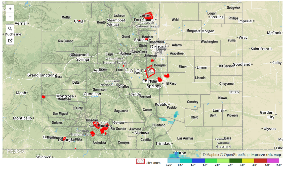
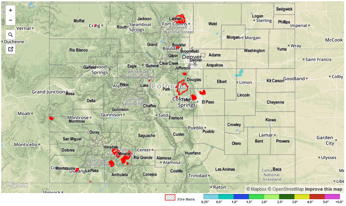
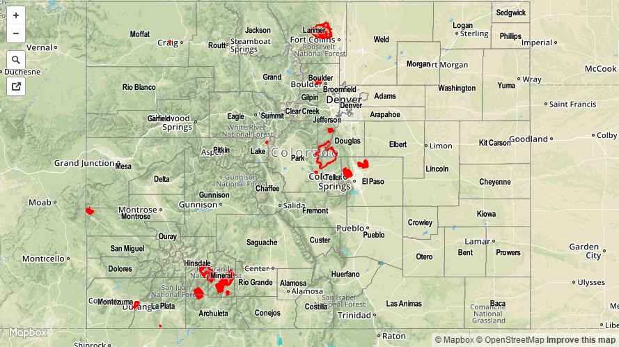
Despite the high dewpoint temperatures yesterday, storms were generally nowhere to be seen. Why? The very dry atmosphere just above the surface quickly obstructed any thunderstorm updrafts looking to grow. The one exception was a set of rogue storms in the Arkansas River headwaters that produced not only a touch of rainfall (less than 0.1 inch) but also pea-sized hail.

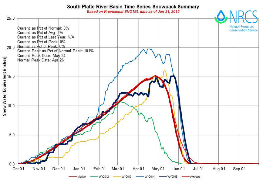
Otherwise, snow melt is nearly complete statewide and all mountain-sourced streams are beginning to subside. The Arkansas River was still in minor flood stage, but on its way down.

STP_snapshot_20150623

STP 06-22-2015: Hot and Dry End to the Weekend

Issue Date: Monday, June 22nd, 2015
Issue Time: 9:00 AM MDT

Summary:

FLOOD WARNINGS/ADVISORIES CONTINUE FOR PORTIONS OF THE CACHE LA POUDRE RIVER, SOUTH PLATTE RIVER, ARKANSAS RIVER, AND VARIOUS STREAMS AND RIVERS ACROSS WESTERN COLORADO DUE TO SNOWMELT AND RAINFALL RUNOFF.

Much the same as the previous two days, yesterday’s weather was marked by abundant sunshine and dry conditions. Warm air aloft kept the environment capped yesterday, and drier conditions allowed the mercury to climb higher than it has since early September 2014. Quite a few locations across the Southeastern Plains reached at, or just above 100 F yesterday, while most locations across the plains found their way into the mid-/upper-90s. The hot temperatures continued snowmelt, and the South Platte River Basin Snowpack has now reached 0.

SPRiver_Snowpack

No flash flooding was reported.

STP_20150622_snapshot

STP 06-21-2015: With High Pressure in Control, the Mercury Climbed

Issue Date: Sunday, June 21st, 2015
Issue Time: 9:00 AM MDT

Summary:

Upper-level ridging continued to sit atop Colorado yesterday, leaving dry air in place across the state. The warm air aloft provided by the westerly winds helped to cap off the environment, only allowing for a few clouds to break up the otherwise completely blue skies. A few isolated showers/weak thunderstorms tried to get going over the preferred terrain, but were shut down quickly by the warm and dry air aloft. Hot temperatures were the main story, and will continue to be today.

No flash flooding was reported yesterday.

20150621_STPImage
Storm Total Precip Legend

STP 06-20-2015: Sunshine and Heat Dominated

Issue Date: Saturday, June 20, 2015
Issue Time: 9:00 AM MDT

Summary:

Upper-level high pressure continued to build across Colorado yesterday, ushering dry and warm air into Colorado, leading to a mostly quiet day across the state. The mercury climbed well into the 90s for lower elevations, reaching 100 in the lower Arkansas River valley and lowest elevations of far western Colorado. A few high based showers/weak thunderstorms developed over the higher terrain, slowly drifted eastward, and produced nothing more than light rain and gusty winds.

No flash flooding was reported yesterday.

06202015_STPImage
Storm Total Precip Legend