STP 08-14-2015: Upper-Level Disturbance Kicked off Scattered Thunderstorms across Eastern Colorado

Issue Date: Friday, August 14th, 2015
Issue Time: 9:00 AM MDT

Summary:

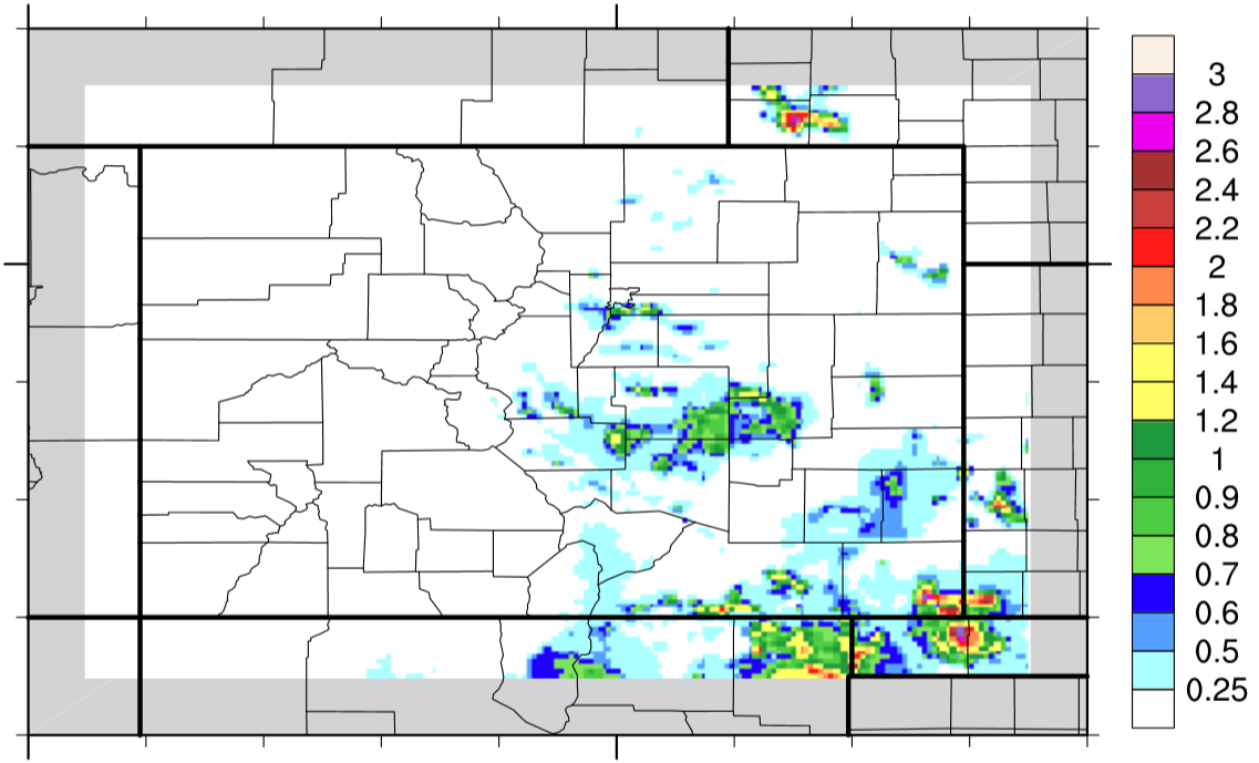
With an upper ridge still in place over Colorado, the environment needed some help to allow for scattered thunderstorms to develop. Along came an upper-level disturbance to provide just that, and eastern Colorado was the target. With the amount of moisture present, precipitation processes were fairly efficient, and slow storm motions allowed for multiple rain gauges to measure near, or above, 1 inch. From CoCoRaHS, those reports include:

Pueblo County: 1.12 inches
Jefferson County: 0.94 inches
Otero County: 0.90 inches
Teller County: 0.71 inches

From National Weather Service reports, heavy rain to the tune of 1.32 inches fell 1 mile S of Beulah (Pueblo County).
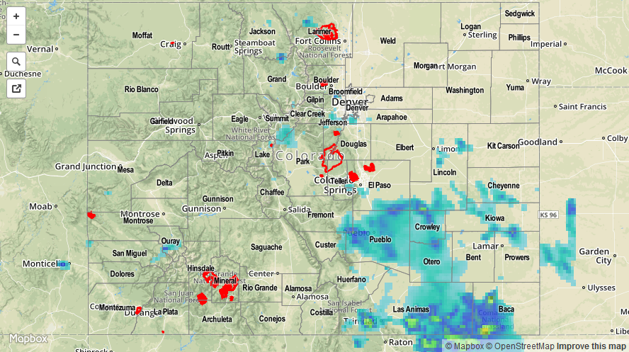
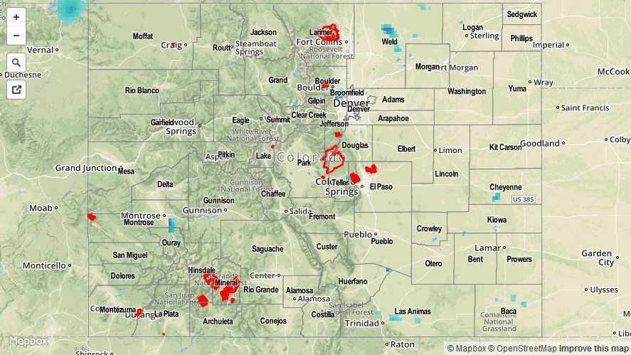
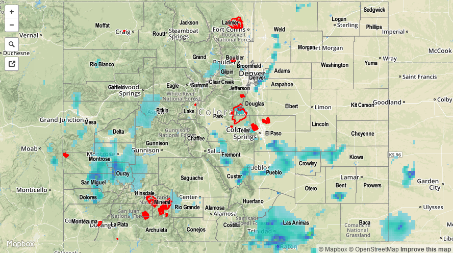
No flash flooding was reported yesterday. For a statewide look at rainfall, please check out the STP map below.

08142015_STPImage
Storm Total Precip Legend

STP 08-13-2015: Noticeable Downtick in Thunderstorm Activity

Issue Date: Thursday, August 13th, 2015
Issue Time: 9:00 AM MDT

Summary:

After a couple days of active weather, Mother Nature provided a bit of a respite with high pressure overhead. Residual moisture under the ridge allowed for isolated thunderstorms to develop during the afternoon and evening hours, mainly over/near the higher terrain. Precipitable water values remained above average, so even with minimal support for thunderstorms, brief periods of moderate-to-heavy rain accompanied the stronger storms. Rainfall totals were typically less than 0.15 inches, but the winners (according to NWS reports and CoCoRaHS observers) were:

Lake County: 0.55 inches
Montrose County: 0.42 inches
Teller County: 0.21 inches
Jefferson County: 0.18 inches

No flash flooding was reported yesterday.

08132015_STPImage
Storm Total Precip Legend

STP 08-12-2015: Quite A Few Heavy Downpours Were Seen Across The State

Issue Date: 8/12/2015
Issue Time: 9:05AM

Summary:

Precipitable water values were incredibly high on the Tuesday, ranging from 1.05 to 1.45 inches across the state. Though atmospheric dynamics were not overly favorable, there was enough instability to generate scattered to even widespread thunderstorms mainly over the higher terrain and areas adjacent to the mountains. Storm coverage was highest over the Southwest Slope, Raton Ridge, Palmer Ridge and the Urban Corridor. Some of the more impressive rain totals were:

  • 4 Urban Drainage and Flood Control District ALERT gages picked up 1.0 to 1.1 inches in less than one hour. The highest 5 minute rain totals were ~0.45 inches in Aurora (this translates to an hourly rain rate of 5.4 inches!)
  • An observer in Fremont County recorded 1.24 inches in about 25 minutes
  • In the evening, a broken line of heavy rainfall produced a quick +/- 1 inch of rain in Ouray and San Miguel counties

Overall, however, one limiting factor to rain accumulation was that the downpours only lasted 30-45 minutes. In addition to heavy rainfall, a few hail reports were received: one in Fremont County of 1 inch hail, and another in Montrose County of “slightly larger than pea sized hail”.

Meanwhile, a robust Denver Cyclone was observed during the afternoon north of the Palmer Ridge. Such a circulation is typically characterized by a very sharp wind shift right along I-25 from Denver northward. To the west downsloping and drier northwesterly winds usually limit heavy rainfall chances. To the east, extra convergence, and vorticity (spin) can result in a flare-up of heavy rainfall producing storms, hail and even tornadoes. Such was the case yesterday. Around 4pm, a funnel was spotted over Aurora. In the map below, we show yesterday after surface observations (from the MesoWest archive), showing the distinct wind shift, which was consistent with the funnel’s location. It is also interesting to note that the heavy rainfall noted above occurred just east of this boundary.

DC_funnel

No official flooding reports were received yesterday. For an estimate of 24-hour rainfall that occurred in your area, please check out our radar based map below.

20150812_STPImage
Storm Total Precip Legend

STP 08-11-2015: Heavy Rain Led to Flash Flooding for Multiple Locations

Issue Date: Tuesday, August 11th, 2015
Issue Time: 9:00 AM MDT

Summary:

Mother Nature put on quite the show yesterday east of the Continental Divide, with scattered thunderstorms producing heavy rainfall. Rain rates yesterday were quite impressive (with more than a few locations experiencing 1 inch+ in less than an hour), which led to multiple reports of Flash Flooding. Those include:

Manitou Springs (El Paso County): Canyon Avenue flooded, A few businesses experienced flood damage
Colorado Springs (El Paso County): Multiple water rescues across town due to flooded roadways
Centennial (Arapahoe County): Several cars stalled and two rescues at University & County Line Road, and University & Dry Creek Road
Pueblo (Pueblo County): 6 inches of water flowing over Pueblo Boulevard

Our Twitter account (@COFloodUpdates) has a collection of photos/reports from yesterday’s storms, so be sure and go take a look.

STP_20150811