STP 08-01-2016: Increased Moisture Led to Uptick in Thunderstorms over Western Colorado

Issue Date: Monday, August 1st, 2016
Issue Time: 9:00 AM MDT

Summary:

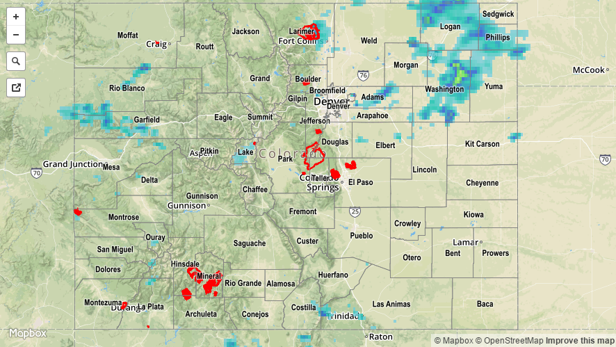
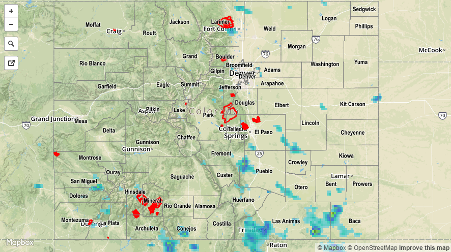
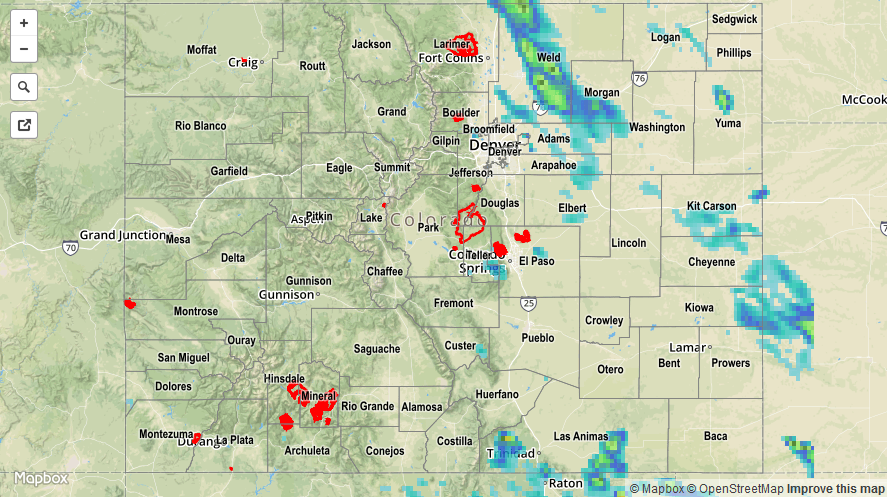
Scattered showers and thunderstorms dotted western Colorado yesterday throughout the day and into the evening hours. A few showers/weak thunderstorms continued until around midnight before tapering off. The heaviest rain of the day fell across the Grand Valley region during the late afternoon/early evening hours as a band of thunderstorms moved through. These storms produced locally heavy rainfall and gusty winds, likely producing minor ponding on roadways.

A weak disturbance aloft pushed across the northern third of Colorado yesterday afternoon and evening, and was responsible for supporting the scattered showers/thunderstorms that rumbled across the Northeast Plains. This activity produced mainly moderate rainfall, gusty winds, and lightning. Bouts of heavy rain attended the stronger activity, likely causing minor flooding of small creeks/streams across northeast Washington County.

The only storm reports submitted yesterday were from thunderstorm wind gusts:

60 mph: 4 miles S of Yuma (Yuma County)
45 mph: 4 miles NNE of Grand Junction (Mesa County)

For a complete look at 24-hour precipitation totals, please take a look at the Storm Total Precipitation map below.

20160801_STPImage
Storm Total Precip Legend

STP 07-31-2016: Deeper Moisture Nudged in from the West

Issue Date: Sunday, July 31st, 2016
Issue Time: 9:00 AM MDT

Summary:

As the high pressure aloft shifted to the east, deeper moisture was allowed to enter the state from the west. The increase in moisture fueled an increase in thunderstorms across the High Country and Western Slope, especially over the higher terrain across southwestern Colorado. Heavy rain and 0.50 inch diameter hail was reported 5 miles E of Norwood (San Miguel County). Additionally, 0.50 inch diameter hail was reported 3 miles WNW of Breen (La Plata County), where moderate rain also lasted long enough to just wet the ground. Scattered showers and weak thunderstorms continued overnight across portions of the Grand Valley, Southwest Slope, and San Juan Mountains. A few are still ongoing for those regions, and an additional wave has brought showers to the Northwest Slope this morning.

A few isolated-to-scattered thunderstorms rumbled over eastern Colorado, but much less in numbers and intensity than previous days. For these regions, the most active were the Raton Ridge and Southeast Plains, where a couple of stronger thunderstorms tapped into deeper moisture to produce hail and heavy rain. 2.40 inches of rain and 0.88 inch diameter hail was reported 10 miles SSW of Kim (Las Animas County).

No flash flooding was reported. For a closer look at rainfall totals in your area, please see the STP map below for a look at 24-hour precipitation totals.

20160731_STPImage
Storm Total Precip Legend

STP 07-30-2016: Northwest Flow Aloft Promotes another Large Hail Day

Issue Date: Saturday, July 30th, 2016
Issue Time: 9:00 AM MDT

Summary:

Dry air out west kept areas west of the Front Range and Southeast Mountains mainly dry and hot, with only a couple isolated, high-based showers/thunderstorms over the higher terrain. These storms produced very little rain, if any, and mainly resulted in gusty outflow winds. To the east, low-level moisture was better, and isolated-to-widely scattered thunderstorms rumbled. Bouts with heavy rain, large hail, and strong winds accompanied the strongest storms. It was Weld County’s turn to take the brunt of the hail, as the severe storm reports below show:

2.5 inch hail: 2 miles ESE of Milton Reservoir (Weld)
2.00 inch hail: Natural Fort Rest Area (Weld), 4 miles E of Lucerne (Weld), 1 mile NE of Fort Lupton (Weld)
1.75 inch hail: 1 mile NW of Ault (Weld), 2 miles NE of Milton Reservoir (Weld), 3 miles N of Greeley (Weld), Ault (Weld), 2 miles NW of Nunn (Weld), 4 miles E of Pierce (Weld), 7 miles SE of Carr (Weld)
1.50 inch hail: S Carr (Weld), Eaton (Weld), NW Pierce (Weld), 1 mile SSW of Fort Lupton (Weld)
1.25 inch hail: Roggen (Weld), ENE Eaton (Weld)
1.0 inch hail: Cripple Creek (Teller), 4 miles W of Carr (Larimer), 1 mile E of Greeley (Weld)

No flash flooding was reported. For a closer look at rainfall totals in your area, please see the STP map below for a look at 24-hour precipitation totals.

20160730_STPImage
Storm Total Precip Legend

STP 07-29-2016: Hot and Mostly Dry over the High Country, Strong/Severe Thunderstorms East

Issue Date: Friday, July 29th, 2016
Issue Time: 9:00 AM MDT

Summary:

The High Country and Western Slope remained mainly dry yesterday as the atmosphere could only an isolated shower/weak thunderstorm or two. Virga was noted under a few showers/thunderstorms; very little rain, if any, reached the surface, as gusty winds were the main result. Due to nearby shower/thunderstorm activity, an outflow wind gust of 39 mph was recorded at the Grand Junction Airport, and a gust of 47 mph was recorded at the La Plata County Airport.

The big weather story of the day were the isolated-to-scattered strong/severe thunderstorms that rumbled across portions of the Urban Corridor, Front Range, Palmer Ridge, Southeast Plains, and Northeast Plains. Heavy rain caused standing water on roadways in Limon, flooded roads in Security-Widefield (where a water rescue was needed), street flooding 2 miles NW of Peterson AFB, and likely caused street/field flooding/ponding underneath the majority of strong/severe thunderstorms due to a combination of heavy rain and hail. The largest reported hail stones were 2.5 inches in diameter: 2 miles S of Peterson AFB (El Paso County), 4 miles WSW of Falcon (El Paso County).

For a complete look at 24-hour precipitation totals, please take a look at the Storm Total Precipitation map below. Keep in mind that hail contamination has likely inflated rainfall totals as estimated by the radar.


Storm Total Precip Legend