STP 05-28-2017: Showers And Storms Dotted The State On Saturday

Issue Date: Sunday, May 28th, 2017
Issue Time: 9:45AM MDT

Summary:

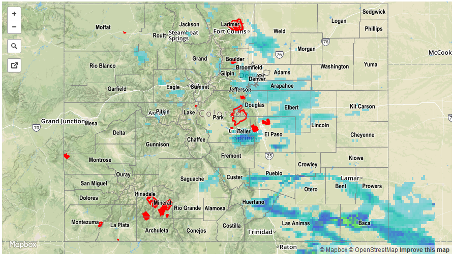
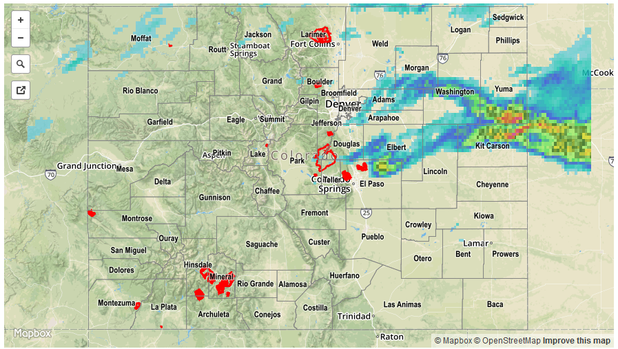
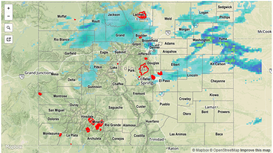
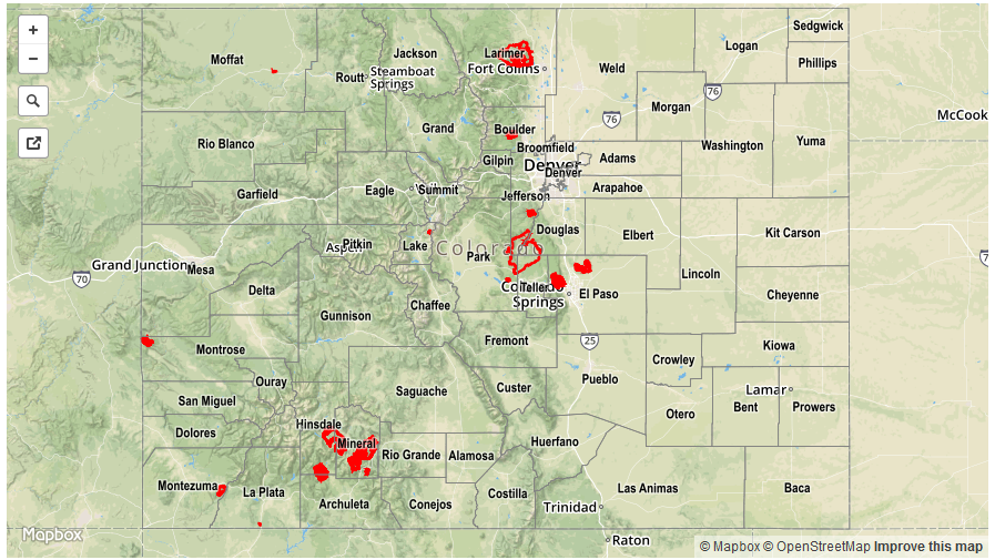
Although more stable air settled into most of Colorado on Saturday, showers were still common as a strong disturbance traversed the state. For the most part, 24-hour rainfall accumulations of 0.25 – 0.5 inches were common, mainly east of the Continental Divide. For many, the rainfall occurred with well below normal temperatures, making us forget that June is almost here.

Instability and the potential for heavy rainfall was limited to southeast Colorado, where a lee-side circulation developed and helped advect the necessary moisture. Several rounds of showers and storms moved across the Palmer Ridge, Southeast Plains and Raton Ridge, causing isolated heavy rainfall as well as hail. The most impressive rainfall totals appear to be in Huerfano and Baca Counties where a few locations likely saw over 1.5 inches (highest rain gauge reading was 1.25 inches). Hail of 1.75 inch diameter was reported as a severe thunderstorm (that even briefly carried a tornado warning) developed over Otero County and then trekked southeastward.

For precipitation estimates in your area, check out our Precipitation Map below. Flooding was not reported on Saturday.


Storm Total Precip Legend

STP 05-27-2017: Another Day Of Severe Weather, Along With Heavy Rain

Issue Date: Saturday, May 27th, 2017
Issue Time: 10:20AM MDT

Summary:

Friday’s thunderstorm activity started around noon, but did not look like it would be all that impressive until later afternoon. At that point, two distinct storm complexes began to cause impacts. A lone supercell-type storm cross southeastward over the Northeast Plains, producing hail up to 2 inches, heavy rainfall and multiple reports of funnels before moving out into Kansas. By early evening, another complex of thunderstorms formed over the higher terrain of the Palmer Ridge, these storms continued to organize as they moved eastward. They produced over 1 inch of quick rainfall, with up to 2.5 inches of rainfall observed in Yuma and Kit Carson counties. Maximum CoCoRaHS reports yesterday were about 2.55 inches with even higher rainfall very likely falling between rain gages. Flash flood warnings were issued by late evening, with Flood Advisories continuing into this morning. Flooding was reported in Yuma County with the observer stating that several smaller roads were washed out.

Elsewhere, scattered showers and weak thunderstorms were noted across mainly northern CO with a few tenths of an inch of rainfall common.

For precipitation estimates in your area, check out our Precipitation Map below.


Storm Total Precip Legend

STP 05-26-2017: Heavy Rain, Wind, Hail, Tornadoes All In The Mix On Thursday

Issue Date: Friday, May 26th, 2017
Issue Time: 10:45AM MDT

Summary:

A large disturbance moving in from the northwest began to affect Colorado on Thursday. Showers and thunderstorms were scattered west of the Continental Divide, and much more numerous to the east, especially across the Northeast Plains. Most activity was fairly benign with rainfall up to 0.5 inches commonly seen. However, a few storms farther east caused large hail (up to 3 inches near the KS border!), a few tornadoes and heavy rainfall exceeding 1.5 inches per hour. Highest observed rainfall amounts were about 0.75 inches. However, in rural areas of Washington and Yuma counties, heavier rainfall likely occurred.

In addition to the precipitation, strong winds affected many locations yesterday. Some wind damage was observed over the Southwest Slope, while elsewhere wind gusts in the 45-60 mph range were common across higher elevation locations.

For precipitation estimates in your area, check out our Precipitation Map below. Flooding was not reported on Thursday.


Storm Total Precip Legend

STP 05-25-2017: Much Warmer, and Mostly Dry on Wednesday

Issue Date: Thursday, May 25th, 2017
Issue Time: 10:15AM MDT

A high pressure ridge briefly setup shop across Colorado on Wednesday, providing plenty of sunshine along with some locally gusty winds. Many lower elevation locations approached the 90F mark, notably Pueblo and Grand Junction. A few light rain and snow showers moved into northwest Colorado overnight as a large disturbance approached the region. However, with a dry atmosphere only a few hundredths of an inch of precipitation was observed.

For precipitation estimates in your area, check out our Precipitation Map below. Flooding was not reported on Wednesday.


Storm Total Precip Legend