STP 06-29-2017: Isolated Showers with Limited Rainfall

Issue Date: Thursday, June 29. 2017
Issue Time: 10:00AM MDT

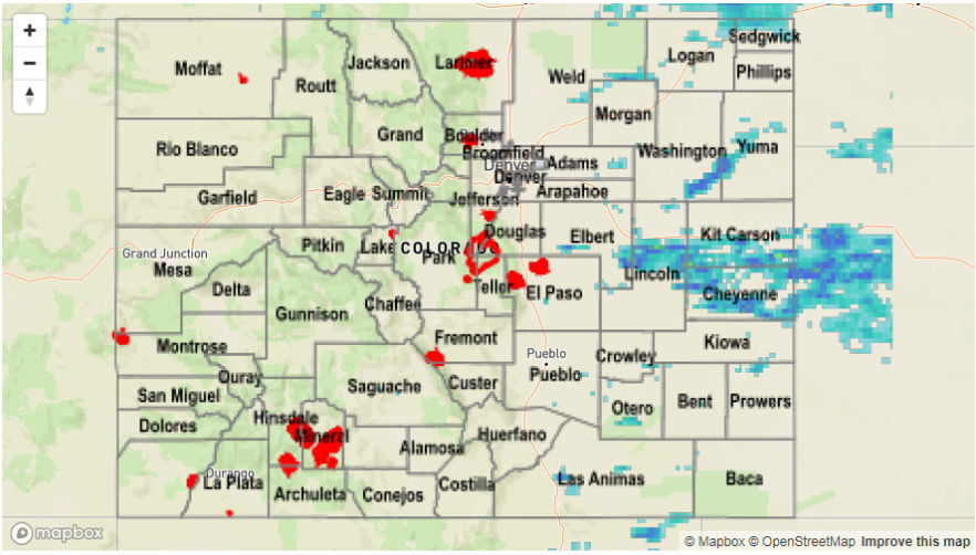
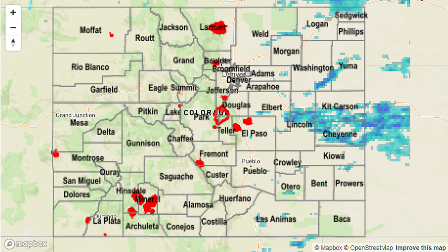
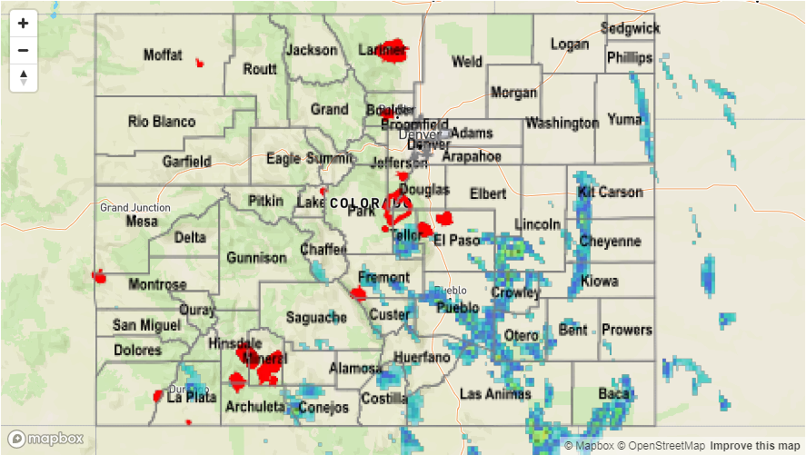
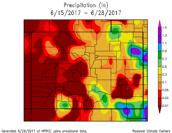
Isolated, high-based showers over the Northeast Plains, Palmer Ridge and Southeast Plains occurred again yesterday. Marginal low-level moisture limited the rainfall from the storms that developed along the KS/NE borders. CoCoRaHS stations in Kit Carson and Cheyenne Counties had rainfall just over 0.5 inches and Burlington- Kit Caron County Airport (KITR) recorded 0.8 inches. Rainfall amounts in the storm cores looked to be just over 1 inch. The main features of these storms were gusty winds. KITR reported a gust of 30mph as thunderstorms passed through the area.

West of the Continental Divide, very dry and windy conditions continued yesterday. Strong westerly winds with gusts up to 30mph were reported throughout the day and into the evening. Temperatures continued to be 5-10F above climatology.

The persistent pattern of weather the last two weeks can be very well seen in a cumulative precipitation map. East of the Continental Divide, there has been little moisture, and therefore almost no rainfall. West of the Divide, isolated showers have developed over the higher terrain almost every afternoon. Coupled with higher moisture, these storms have brought consistent rainfall to the Northeast and Southeast Plains.

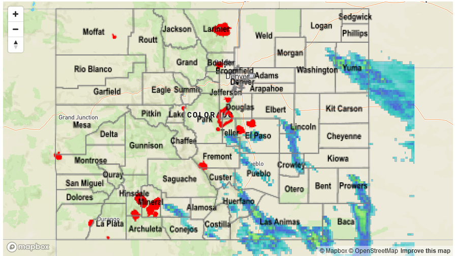
Flooding was not reported on Wednesday. Please see the STP map below for a look at 24-hour precipitation totals.

Storm Total Precip Legend

STP 06-28-2017: Gusty Winds both East and West of the Continental Divide

Issue Date: Wednesday, June 28, 2017
Issue Time: 10:15AM MDT

Strong westerly flow aloft limited the amount of moisture available for thunderstorms in the High Country, Northeast Plains and Southeast Plains. Below, the low dew point temperatures show the lack of moisture at 4 pm MDT yesterday. West of the Continental Divide, the dew points were in the teens. Downward mixing of the strong upper level winds created gusty conditions on the Western Slope. A wind gust of 51mph was reported in Mack, CO at 1:30PM MDT.

A north/south dry line formed east of the Continental Divide in the afternoon limiting moisture to the Northeast/Southeast Plains. Denver recorded a 43F dew point early in the morning, and it had dropped to 29F by the afternoon. The drop in moisture from the previous days along the CO/KS border caused thunderstorms to produce gusty outflows and little rain. Outside Burlington, a 59mph gust outflow from a thunderstorm was reported at 9pm. Rainfall estimates (below) were around 0.25 inches to 0.60 inches with most storms and up to 1.75 inches under the small storm cores. CoCoRaHS data has the highest recorded rainfall amount in the northeast corner of Cheyenne County at 0.39 inches. This is in an area were rainfall estimates are in the range of 0.50 and 0.90 inches, so the radar rainfall estimates may be too high due to both dry sub-cloud air and hail contamination.


No flooding occurred yesterday. Please see the STP map below for a look at 24-hour precipitation totals.

Storm Total Precip Legend

STP 06-27-2017: Scattered Showers over Southeastern High Country and Plains

Issue Date: Tuesday, June 27th, 2017
Issue Time: 10:27AM MDT

Summary:

The persistent weather pattern, marked by a weak upper-level ridge centered west of Colorado, continued its hold again yesterday. West of the Continental Divide, it was extremely warm and dry with Grand Junction reaching a high of 98F. East of the divide, the day began with very high low-level moisture. Dewpoints were 60F at Pueblo and surrounding regions at 9am. Over the Palmer Ridge and Northeast Plains, much of this low-level moisture quickly mixed out in the late morning hours limiting the number of scattered storms in the afternoon. However, a storm that formed in Wray reported ping pong sized hail around 4pm, causing broken windows and was accompanied by a small funnel cloud.

Upslope flow triggered a handful of severe thunderstorms storms south of I-70 and over the Southern high country where high moisture did not mix out. Near Durango, a spotter reported 0.61 inches in a 25 minute period. Most other storms dropped 1-1.5 inches of rain with storm centers closer to 2 inches. Under the stronger cells, 1-1.75 inch hail was also reported. There were two flash flood warnings and advisories issued over burn scars due to the slow moving storms. One warning over the Junkins Burn Scar and an advisory for the Waldo Canyon burn scar outside of Colorado Springs.

No flooding occurred yesterday (at least as of this morning). Please see the STP map below for a look at 24-hour precipitation totals.

Storm Total Precip Legend

STP 06-26-2017: Scattered T’Storms With Heavy Rainfall Across Southeast

Issue Date: Monday, June 26th, 2017
Issue Time: 9:50AM MDT

Summary:

An accurate word to describe Sunday’s weather across our state is “persistent”. With a weak upper-level ridge centered west of Colorado, subsidence and generally clear skies continued to be the rule west of the Continental Divide.

Of course, the devil is always in the details. To the east, despite a persistent atmosphere aloft, slow and steady moisture return increased low level moisture and provided more fuel (compared to Saturday) for isolated to scattered thunderstorms. The focal points, and highest storm coverage, were off the south face of the Palmer Ridge and the Raton Ridge, especially the Wet Mountains. Several rounds of storms were observed, mainly limited to the foothills. Generally, rainfall was not overly impressive with 0.5 to 0.75 inches common under the storm cores. However, the exception was an isolated, severe storm in Baca County where a Local Storm Report noted 1.5 inches of rain in 10 minutes (!), a roughly 1 in 100 year event. In addition, the storm dropped copious amounts of small hail and prompted a tornado warning as soon as it crossed into New Mexico. A few other storms farther west produced over 1 inch of rain across large swaths of Las Animas and Huerfano counties. Although storms fell mainly over ungauged areas, the USGS gauge on the Purgatoire River near Thatcher (Las Animas County) showed an impressive spike (see below).

As of this morning, flooding was fortunately not reported from Sunday’s rains. For rainfall estimates in your area, check out the State Precipitation Map below.

Storm Total Precip Legend